Irkut (river)
The Irkut (Russian: Ирку́т; Buryat and Mongolian: Эрхүү гол, Erhüü gol) is a river in the Buryat Republic and Irkutsk Oblast of Russia. It is a left tributary of the Angara. It flows out of lake Ilchir which is situated 50 km away from the highest peak of the Eastern Sayan Mountains, Munku-Sardyk. The length of the river is 488 kilometers (303 mi). The area of its basin is 15,000 square kilometers (5,800 sq mi).[1] The Irkut freezes up in late October or mid-November and stays icebound until late April or early May. The city of Irkutsk is located at the mouth of the Irkut on the Angara.[2]
| Irkut | |
|---|---|
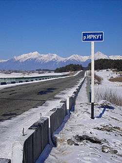 Road sign r. Irkut near the village Zaktuy in Tunkinsky District of Buryatia | |
| Location | |
| Country | Russia |
| Physical characteristics | |
| Mouth | Angara |
• coordinates | 52.2907°N 104.2754°E |
| Length | 488 km (303 mi) |
| Basin size | 15,000 km2 (5,800 sq mi) |
| Basin features | |
| Progression | Angara→ Yenisey→ Kara Sea |
Pictures
 Irkut near the village of Zaktuy in Tunkinsky District of Buryatia (2005)
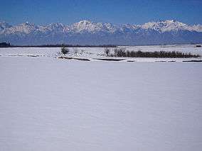
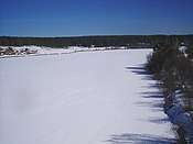 Irkut near the village of Zaktuy in Tunkinsky District of Buryatia (2005)
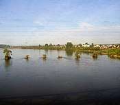 Irkut in summer outside Irkutsk near the confluence with the Angara
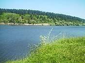 Irkut in summer 2010 near Shelekhov
gollark: Again, why? Before an egg is fertilized, there must necessarily exist some point at which it wasn't yet but that was likely to happen soon.
gollark: Does that matter? They're still ultimately quite likely to produce a zygote and then quite likely to produce a fetus and whatever else after that.
gollark: Yes.
gollark: Probably wouldn't work very well otherwise.
gollark: I assume that sperm have some sort of magic™ egg-finding capability.
References
| Wikimedia Commons has media related to Irkut River. |
- Река Иркут in the State Water Register of Russia (Russian)
- Curtin, J. (1910). A Journey In Southern Siberia: The Mongols, Their Religion and Their Myths. Library of Alexandria. London. p. pt21. ISBN 978-1-4655-2060-9. Retrieved June 7, 2019.
| Authority control |
|
|---|
This article is issued from Wikipedia. The text is licensed under Creative Commons - Attribution - Sharealike. Additional terms may apply for the media files.