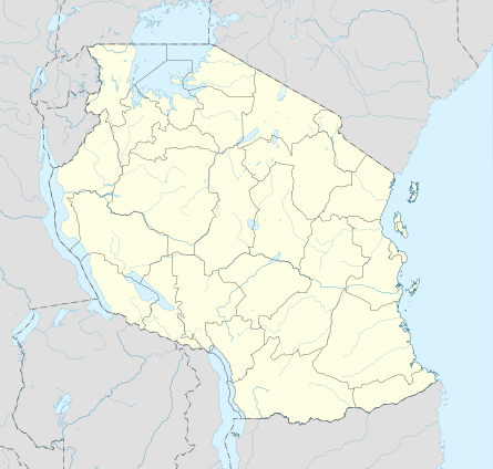
Iringa Urban District
Iringa Urban District is one of the five districts of the Iringa Region of Tanzania. It is bordered to the north, east, and west by the Iringa Rural District and to the south by the Kilolo District.
Iringa Urban District | |
|---|---|
 Iringa Urban District Location in Tanzania | |
| Coordinates: 07°46′57″S 35°41′59″E | |
| Country | Tanzania |
| Region | Iringa Region |
| District | Iringa Urban District |
| Government | |
| • Type | City Council |
| Population (2012 Census) | |
| • Total | 151,345 |
| Time zone | GMT + 3 |
According to the 2012 census, the population of the Iringa Urban District was 151,345.[1]
Wards
The Iringa Municipality is administratively divided into 18 wards:
gollark: I think communism and socialism are about more than land use, though?
gollark: Clearly the best approach is to give me all economic data and run ??? algorithms on it to extract the optimal economic plan.
gollark: I didn't say you did say that, but you did say "lot of my friends do this and rent the property for next to nothing as a fuck you to capitalism".
gollark: Also, they could probably just live somewhere with less wildly inflated house pricing.
gollark: > I want the scientists in society to have a place to exist too.I mean, I don't disagree, but just "give whoever rents it first a freeish house" doesn't seem like a good mechanism for that. Unless you mean they do "give whoever they find cool a freeish house", which is... also bad in other ways.
References
- "Population Distribution by Administrative Units, United Republic of Tanzania, 2013" (PDF). Archived from the original (PDF) on 2013-05-02. Retrieved 2013-05-24.
This article is issued from Wikipedia. The text is licensed under Creative Commons - Attribution - Sharealike. Additional terms may apply for the media files.