Ioka, Utah
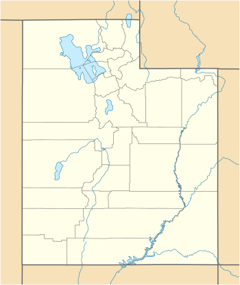
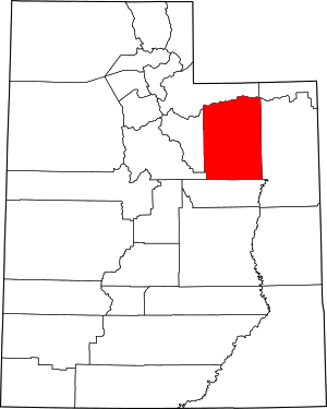
Ioka is an unincorporated community in eastern Duchesne County, Utah, United States.[1]
Ioka, Utah | |
|---|---|
 Ioka Location within the state of Utah | |
| Coordinates: 40.2585694°N 110.1137626°W | |
| Country | United States |
| State | Utah |
| County | Duchesne |
| Settled | 1907 |
| Elevation | 5,351 ft (1,631 m) |
| Time zone | UTC-7 (Mountain (MST)) |
| • Summer (DST) | UTC-6 (MDT) |
| ZIP codes | 84066 |
| GNIS feature ID | 1437594[1] |
Description
The small farming community is located in a "little valley surrounded by bluffs" within the Uinta Basin, about 5 miles (8.0 km) northwest of Myton and about 7 miles (11 km) southwest of Roosevelt[2][3] It is located on the Uintah and Ouray Indian Reservation and was named after a Ute chief. The name means "bravado".[3]
The main (and the only paved) road in the community is Utah State Route 87 (SR‑87/Ioka Lane/West 3000 South), which runs east‑west through the community. SR‑87 connects with U.S. Route 40/U.S. Route 191 at its eastern terminus at Ioka Junction, about the 2.8 miles (4.5 km) east of town.[4]
History
The community was first settled in 1907 and named Mural (meaning a "walled in valley"), but the name was changed to Ioka by about 1915.[2][3] In 1908 a post office for the community was established, and remained in operation until 1944.[5]
See also
![]()
References
- U.S. Geological Survey Geographic Names Information System: Ioka
- Jensen, Andrew (1941). "Encyclopedic History of The Church Of Jesus Christ Of Latter-day Saints". Salt Lake City: Deseret News Publishing Company: 364. OCLC 3188924. Retrieved 13 Apr 2019 – via Internet Archive. Cite journal requires
|journal=(help) - Van Cott, John W. (1990). Utah Place Names: A Comprehensive Guide to the Origins of Geographic Names: A Compilation. Salt Lake City: University of Utah Press. p. 200. ISBN 978-0-87480-345-7. OCLC 797284427. Retrieved 10 Mar 2018.
- Google (13 Apr 2019). "Ioka, Utah 84066" (Map). Google Maps. Google.
- Forte, Jim. "Duchesne County". postalhistory.com. Las Vegas, Nevada. Retrieved 13 Apr 2019.
