Innis Mhòr
Innis Mhòr is a tidal island in the Dornoch Firth of Easter Ross off the east coast of Scotland. It is about 26 hectares (64 acres) in extent and is largely, if not exclusively made up of moving sand dunes. No point on the island is greater than 5 metres (16 ft) above sea level. It has almost certainly never been permanently inhabited. The nearest settlement is Inver to the south, (which is 5 kilometres (3.1 mi) west of Portmahomack) and the town of Tain is 8 kilometres (5.0 mi) to the east.
| Gaelic name | Innis Mhòr, |
|---|---|
| Meaning of name | big island |
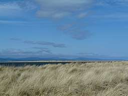
 Rubh' na h-Innse Moire in the foreground with Innis Mhòr beyond and the hills of Sutherland in the background. | |
| Location | |
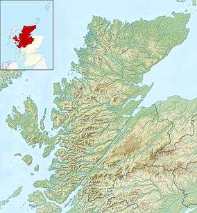
 Innis Mhòr Innis Mhòr shown within Highland Scotland | |
| OS grid reference | NH849862 |
| Coordinates | 57.851°N 3.94°W |
| Physical geography | |
| Island group | Outlier |
| Area | 26 ha |
| Highest elevation | <5 m[1] |
| Administration | |
| Sovereign state | United Kingdom |
| Country | Scotland |
| Council area | Highland |
| Demographics | |
| Population rank | n/a [2] |
Scotland's north and west coasts have over 700 islands all told.[3] Innis Mhòr is one of the few east coast islands, only 4 of which exceed 20 hectares (49 acres) in size.[4]
The extensive tidal Whiteness Sands lie between Innis Mhòr and the Easter Ross coast, with the headland of Rubh' na h-Innse Moire lying to the west of the island. Inland there is the Morrich More, an extensive area of dune grassland with wetland communities,[5] and a grade 1 SSSI, and RAF Tain, a bombing range on an alluvial plain known as the Fendom.[6] The area includes the most extensive area (260 hectares (1.0 sq mi)) of salt marsh in the Highlands.[7] The island is part of the Dornoch Firth National Scenic Area, one of 40 in Scotland.[8]
Local birdlife includes important populations of osprey (10 pairs representing about 10% of the UK breeding population), bar-tailed godwit, greylag goose and wigeon and numerous more common species such as curlew, dunlin, oystercatcher and teal.[9]
There are no other islands nearby, although a sandy spit to the south is marked as Innis Bheag (meaning "small island") on some maps and is also referred to as Paterson Island.[6][10]
References
- Haswell-Smith, Hamish (2004). The Scottish Islands. Edinburgh: Canongate. ISBN 978-1-84195-454-7.
- Road Atlas of Britain (1978) London; Bartholomew.
Notes
- "Get-a-Map". Ordnance Survey. Retrieved 29 November 2009.
- Area and population ranks: there are c. 300 islands over 20 ha in extent and 93 permanently inhabited islands were listed in the 2011 census.
- "Scotland in Short" (2003) (pdf) Scottish Executive. Retrieved 29 November 209.
- The others are Mugdrum in the Firth of Tay and the Isle of May and Inchkeith in the Firth of Forth.
- "Loch Eye, Ross and Cromarty District, Highland Region". Greenland White-fronted Goose Study. Archived from the original on 22 April 2012. Retrieved 23 November 2009.
- Hansom, JD and Black, SDL (1996) "The Geomorphology of Morrich More: Management Prescription Review" Archived 2016-03-03 at the Wayback Machine (pdf) SNH. Retrieved 29 November 2009.
- J.D. Hansom. "Morrich More" (PDF). Coastal Geomorphology of Great Britain: Chapter 10 Saltmarshes. JNCC. 28. Retrieved 23 November 2009.
- "National Scenic Areas" Archived 2017-03-11 at the Wayback Machine. SNH. Retrieved 30 Mar 2011.
- "Dornoch Firth and Loch Fleet SPA". JNCC. Retrieved 23 November 2009.
- Road Atlas of Britain (1978) p. 87