Indus, Minnesota
Indus is an unincorporated community in Koochiching County, Minnesota, United States.
Indus | |
|---|---|
 Indus  Indus | |
| Coordinates: 48°37′31″N 93°50′16″W | |
| Country | United States |
| State | Minnesota |
| County | Koochiching |
| Elevation | 1,106 ft (337 m) |
| Time zone | UTC-6 (Central (CST)) |
| • Summer (DST) | UTC-5 (CDT) |
| ZIP code | 56623 or 56629 |
| Area code(s) | 218 |
| GNIS feature ID | 645426[1] |
The community is located between International Falls and Baudette on State Highway 11 (MN 11).
Indus is located within Northwest Koochiching Unorganized Territory.
County Road 83, Town Road 297, and the Rainy River are all in the vicinity.
Nearby places include Birchdale, Loman, and Emo. Indus is located 30 miles west of International Falls; and 38 miles east of Baudette.
In Indus, there is a school called Indus School which serves as a K-12 Outdoor Education Magnet School
History
A post office called Indus was established in 1902, and remained in operation until 1974.[2] The community was named after the Indus River in Asia.[3]
gollark: Phones have accursedly horrible boot processes and software stacks.
gollark: Phone #1 died to screen damage and then being consigned to wait for replacement parts forever, phone #2 died to a manufacturing defect (friend's identical one had it too) where the micro-USB port apioformed, phone #3 mysteriously had touchscreen failure, phone #4 is working but has a somewhat degraded battery.
gollark: All my phones have suffered damage of some kind to non-core parts, because apparently the computer bits are extremely reliable.
gollark: You would need an ESP32 *and* screen thing *and* 4G modem.
gollark: Macron cannot do any operation on integers except 3n+1 and n/2.
References
- "Indus, Minnesota". Geographic Names Information System. United States Geological Survey.
- "Koochiching County". Jim Forte Postal History. Retrieved 17 July 2015.
- Warren Upham (1920). Minnesota Geographic Names: Their Origin and Historic Significance. Minnesota Historical Society. p. 283.
- Rand McNally Road Atlas – 2007 edition – Minnesota entry
- Official State of Minnesota Highway Map – 2011/2012 edition
- Mn/DOT map of Koochiching County – Sheet 3 – 2011 edition
Municipalities and communities of Koochiching County, Minnesota, United States | ||
|---|---|---|
| Cities | 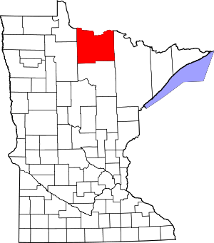 Map of Minnesota highlighting Koochiching County | |
| Unorganized territories | ||
| Unincorporated communities | ||
| Indian reservations | ||
| Ghost towns | ||
| Footnotes | ‡This populated place also has portions in an adjacent county or counties | |
This article is issued from Wikipedia. The text is licensed under Creative Commons - Attribution - Sharealike. Additional terms may apply for the media files.