Inabanga, Bohol
Inabanga, officially the Municipality of Inabanga (Cebuano: Lungsod sa Inabanga; Tagalog: Bayan ng Inabanga), is a 3rd class municipality in the province of Bohol, Philippines. According to the 2015 census, it has a population of 45,880 people.[3]
Inabanga | |
|---|---|
| Municipality of Inabanga | |
Inabanga main street | |
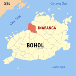 Map of Bohol with Inabanga highlighted | |
OpenStreetMap 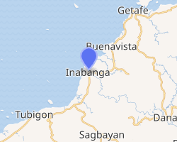
| |
.svg.png) Inabanga Location within the Philippines | |
| Coordinates: 10°02′N 124°04′E | |
| Country | |
| Region | Central Visayas (Region VII) |
| Province | Bohol |
| District | 2nd District |
| Barangays | 50 (see Barangays) |
| Government | |
| • Type | Sangguniang Bayan |
| • Mayor | Josephine Socorro C. Jumamoy |
| • Vice Mayor | Rodrigo U. Jumamoy |
| • Congressman | Erico Aristotle C. Aumentado |
| • Electorate | 26,345 voters (2013) |
| Area | |
| • Total | 125.63 km2 (48.51 sq mi) |
| Population (2015 census)[3] | |
| • Total | 45,880 |
| • Density | 370/km2 (950/sq mi) |
| • Households | 7,485 |
| Economy | |
| • Income class | 3rd municipal income class |
| • Poverty incidence | 31.11% (2015)[4] |
| • Revenue (₱) | 113,960,963.82 (2016) |
| Time zone | UTC+8 (PST) |
| ZIP code | 6332 |
| PSGC | |
| IDD : area code | +63 (0)38 |
| Climate type | tropical monsoon climate |
| Native languages | Boholano dialect Cebuano Eskayan Tagalog |
| Website | www |
Inabanga was the site of the 2017 Bohol clashes between Philippine security forces and Moro ISIL-affiliated militants led by members of the Abu Sayyaf.
The town of Inabanga, Bohol celebrates its fiesta on June 10, to honor the town patron, Saint Paul.[5]
Geography
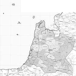
The municipality is located at the mouth of the Inabanga River, the largest river in Bohol.[6]
Land use:[7]
- Timberland area: 5,305 ha (13,110 acres)
- Mangrove area: 767 ha (1,900 acres)
- Alienable & Disposable (A & D): None
Soil cover:[7]
- Bantog clay
- Inabanga clay
- Bolinao clay
- Annam clay
- Hydrosol
Barangays
Inabanga comprises 50 barangays:
| PSGC | Barangay | Population | ±% p.a. | |||
|---|---|---|---|---|---|---|
| 2015[3] | 2010[8] | |||||
| 071224001 | Anonang | 1.6% | 748 | 721 | 0.70% | |
| 071224002 | Bahan | 1.4% | 651 | 464 | 6.66% | |
| 071224003 | Badiang | 2.4% | 1,085 | 1,083 | 0.04% | |
| 071224005 | Baguhan | 1.1% | 501 | 541 | −1.45% | |
| 071224007 | Banahao | 1.7% | 760 | 652 | 2.96% | |
| 071224008 | Baogo | 2.7% | 1,226 | 1,252 | −0.40% | |
| 071224009 | Bugang | 1.8% | 810 | 696 | 2.93% | |
| 071224010 | Cagawasan | 3.2% | 1,452 | 1,290 | 2.28% | |
| 071224011 | Cagayan | 0.9% | 429 | 390 | 1.83% | |
| 071224012 | Cambitoon | 2.5% | 1,132 | 919 | 4.05% | |
| 071224013 | Canlinte | 0.6% | 276 | 276 | 0.00% | |
| 071224014 | Cawayan | 2.1% | 969 | 1,147 | −3.16% | |
| 071224015 | Cogon | 1.8% | 820 | 865 | −1.01% | |
| 071224016 | Cuaming | 6.4% | 2,951 | 2,826 | 0.83% | |
| 071224017 | Dagnawan | 1.4% | 630 | 637 | −0.21% | |
| 071224018 | Dagohoy | 3.4% | 1,540 | 1,310 | 3.13% | |
| 071224019 | Dait Sur | 1.7% | 778 | 622 | 4.35% | |
| 071224020 | Datag | 1.4% | 661 | 559 | 3.24% | |
| 071224021 | Fatima | 1.9% | 861 | 721 | 3.44% | |
| 071224022 | Hambongan | 1.5% | 666 | 523 | 4.71% | |
| 071224023 | Ilaud (Poblacion) | 1.9% | 861 | 954 | −1.93% | |
| 071224024 | Ilaya | 0.9% | 414 | 376 | 1.85% | |
| 071224025 | Ilihan | 0.9% | 414 | 398 | 0.75% | |
| 071224027 | Lapacan Norte | 0.9% | 396 | 350 | 2.38% | |
| 071224028 | Lapacan Sur | 2.6% | 1,187 | 1,217 | −0.47% | |
| 071224029 | Lawis | 2.8% | 1,297 | 1,389 | −1.30% | |
| 071224030 | Liloan Norte | 3.3% | 1,492 | 1,490 | 0.03% | |
| 071224031 | Liloan Sur | 2.5% | 1,165 | 954 | 3.88% | |
| 071224032 | Lomboy | 1.3% | 591 | 589 | 0.06% | |
| 071224033 | Lonoy Cainsican | 1.5% | 696 | 656 | 1.13% | |
| 071224034 | Lonoy Roma | 1.3% | 581 | 593 | −0.39% | |
| 071224035 | Lutao | 2.6% | 1,199 | 1,173 | 0.42% | |
| 071224036 | Luyo | 1.8% | 822 | 732 | 2.23% | |
| 071224037 | Mabuhay | 1.0% | 449 | 383 | 3.07% | |
| 071224038 | Maria Rosario | 1.7% | 764 | 424 | 11.86% | |
| 071224039 | Nabuad | 4.4% | 1,998 | 1,804 | 1.96% | |
| 071224040 | Napo | 1.6% | 728 | 706 | 0.59% | |
| 071224041 | Ondol | 2.4% | 1,107 | 1,122 | −0.26% | |
| 071224042 | Poblacion | 2.1% | 966 | 930 | 0.73% | |
| 071224043 | Riverside | 0.6% | 260 | 260 | 0.00% | |
| 071224044 | Saa | 1.3% | 619 | 634 | −0.45% | |
| 071224045 | San Isidro | 1.8% | 844 | 992 | −3.03% | |
| 071224046 | San Jose | 4.6% | 2,116 | 1,566 | 5.90% | |
| 071224047 | Santo Niño | 1.5% | 686 | 799 | −2.86% | |
| 071224048 | Santo Rosario | 2.4% | 1,117 | 997 | 2.19% | |
| 071224049 | Sua | 1.5% | 709 | 554 | 4.81% | |
| 071224050 | Tambook | 1.0% | 464 | 490 | −1.03% | |
| 071224051 | Tungod | 2.6% | 1,184 | 1,089 | 1.61% | |
| 071224052 | U‑og | 2.1% | 957 | 1,112 | −2.82% | |
| 071224053 | Ubujan | 2.4% | 1,111 | 1,064 | 0.83% | |
| Total | 45,880 | 43,291 | 1.11% | |||
Climate
| Climate data for Inabanga, Bohol | |||||||||||||
|---|---|---|---|---|---|---|---|---|---|---|---|---|---|
| Month | Jan | Feb | Mar | Apr | May | Jun | Jul | Aug | Sep | Oct | Nov | Dec | Year |
| Average high °C (°F) | 28 (82) |
28 (82) |
29 (84) |
31 (88) |
31 (88) |
30 (86) |
30 (86) |
30 (86) |
30 (86) |
29 (84) |
29 (84) |
28 (82) |
29 (85) |
| Average low °C (°F) | 23 (73) |
23 (73) |
23 (73) |
23 (73) |
24 (75) |
24 (75) |
24 (75) |
24 (75) |
24 (75) |
24 (75) |
24 (75) |
23 (73) |
24 (74) |
| Average precipitation mm (inches) | 98 (3.9) |
82 (3.2) |
96 (3.8) |
71 (2.8) |
104 (4.1) |
129 (5.1) |
101 (4.0) |
94 (3.7) |
99 (3.9) |
135 (5.3) |
174 (6.9) |
143 (5.6) |
1,326 (52.3) |
| Average rainy days | 18.0 | 14.1 | 17.1 | 16.8 | 23.7 | 25.7 | 25.8 | 23.3 | 24.2 | 25.9 | 24.0 | 20.6 | 259.2 |
| Source: Meteoblue [9] | |||||||||||||
Demographics
|
| ||||||||||||||||||||||||||||||||||||||||||||||||
| Source: Philippine Statistics Authority[3][8][10][11] | |||||||||||||||||||||||||||||||||||||||||||||||||
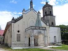
Predominant religion: Roman Catholic
Economy
Annual Income (2014):[7] ₱68,144,172
Major industries:[7]
- farming
- fishing
- mat-weaving
- nipa thatch-making
Tourism
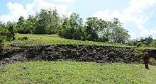
The North Bohol fault, which appeared during the 2013 Bohol earthquake, became a tourist attraction in Bohol province.[12]
Infrastructure
Utilities
Water supply:[7]
- Main source of potable water: Groundwater
- L1 facilities – 489 water wells
- L2 systems in brgy Pob.
- L3 systems serving 22 barangays
- Potable water demand (1998): 73,230 cubic metres (19,000,000 US gal; 59 acre⋅ft) per day
Energization status (2010):[7]
- 50 barangays energized
- 8,710 actual household connections (98%)
- 8,900 potential house connections
Number of households with access to sanitary toilets: 7,686 (86%)
Welfare[7]
- Number of Barangay Health Stations: 28
- Number of Hospitals: None
- Number of Municipal Health Centers: None
- Number of Day Care Centers: 50
Education
Literacy rate: 92%
Secondary and high schools:[13][14]
- North
- Cuaming HS
- Inabanga HS - Nabuad
- Inabanga North Integrated School
- San Jose NHS
- South
- Saint Paul's Academy
- Dagnawan Integrated School
- Southern Inabanga HS
Elementary and primary schools:[15]
- North
- Anonang ES
- Baogo ES
- Cambitoon ES
- Cuaming ES
- Dait Sur ES
- Datag ES
- Hambongan ES
- Inabanga North Integrated Sch.
- Lawis ES
- Liloan Norte ES
- Liloan Sur ES
- Nabuad ES
- Ondol ES
- San Isidro ES
- San Jose ES
- South
- Banahao ES
- Cagawasan ES
- Cawayan ES
- Dagnawaan Integrated Sch.
- Dagohoy ES
- Inabanga South Central ES
- Lutao ES
- Santo Rosario ES
- U-og Ubujan ES
References
- "Municipality". Quezon City, Philippines: Department of the Interior and Local Government. Retrieved 31 May 2013.
- "Province: Bohol". PSGC Interactive. Quezon City, Philippines: Philippine Statistics Authority. Retrieved 12 November 2016.
- Census of Population (2015). "Region VII (Central Visayas)". Total Population by Province, City, Municipality and Barangay. PSA. Retrieved 20 June 2016.
- "PSA releases the 2015 Municipal and City Level Poverty Estimates". Quezon City, Philippines. Retrieved 12 October 2019.
- "Bohol Festivals Timetable". "www.bohol-philippines.com". Retrieved 2019-03-06.
- Villegas, Ramon N., ed. (2003). Tubod : the heart of Bohol. Manila: National Commission for Culture and the Arts. ISBN 9718140360.
- "Municipality of Inabanga". www.bohol.gov.ph. Official website of the Province of Bohol. Retrieved 19 December 2014.
- Census of Population and Housing (2010). "Region VII (Central Visayas)". Total Population by Province, City, Municipality and Barangay. NSO. Retrieved 29 June 2016.
- "Inabanga: Average Temperatures and Rainfall". Meteoblue. Retrieved 9 May 2020.
- Censuses of Population (1903–2007). "Region VII (Central Visayas)". Table 1. Population Enumerated in Various Censuses by Province/Highly Urbanized City: 1903 to 2007. NSO.
- "Province of Bohol". Municipality Population Data. Local Water Utilities Administration Research Division. Retrieved 17 December 2016.
- "Post-earthquake Bohol: Silver lining after the disaster". DENR. Archived from the original on 25 January 2017.
- "List of High Schools". DepEd - Bohol. January 1, 2015. Retrieved 5 March 2015.
- "Catholic Educational Institutions". Roman Catholic Diocese of Talibon. January 1, 2014. Archived from the original on February 4, 2015. Retrieved 5 March 2015.
- "List of Elementary Schools". DepEd – Bohol. January 1, 2015. Retrieved 5 March 2015.
External links
| Wikimedia Commons has media related to Inabanga, Bohol. |