Iloilo City Proper
Iloilo City Proper (City Proper) (simply known as Ciudad, Iloilo Poblacion or Iloilo) is one of the seven districts also known as the center or heart of Iloilo City. It received its present name from the province's original Irong-Irong reference. It was founded as La Punta and inhabited in 1602 when Spanish and Chinese residents from Jaro and Molo expanded their territorial area. During its heyday, it was called Yloylo or Iloilo.[2]
City Proper, Iloilo | |
|---|---|
Iloilo City District | |
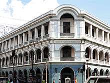  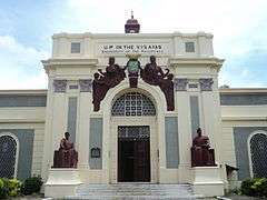 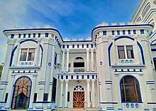 .jpg)  From upper-left to right, middle-left to right and bottom-left to right: Edificio de Villanueva; Ayuntamiento de Iloilo (Iloilo City Hall); UPV Art Gallery (Old Iloilo City Hall); Castillo de Don Juan Ledesma (Don Juan Ledesma Castle); Aduana de Iloilo (Iloilo Customs House); Plaza de Aduana (Sunburst Park) | |

| |
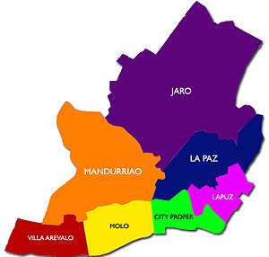
.svg.png) City Proper, Iloilo Location in the Philippines .svg.png) City Proper, Iloilo City Proper, Iloilo (Philippines) | |
| Coordinates: 10°41′24″N 122°33′0″E | |
| Country | |
| Region | Western Visayas (Region VI) |
| Province | Iloilo |
| City | Iloilo City |
| Established | 1602 as La Punta (settlement by the Spanish colonists) |
| Cityhood | 1890 (cityhood during Spanish colonial regime) |
| Reincorporation | July 16, 1937 |
| Government | |
| • Mayor | Geronimo "Jerry" P. Trenas (Mayor of Iloilo City) |
| Area | |
| • Total | 3.75 km2 (1.45 sq mi) |
| Demonym(s) | Ilonggo (masculine) Ilongga (feminine) |
| Time zone | UTC+8 (PST) |
| Patron saint |
|
| Feast day | Fourth Sunday of January in honor of Señor Santo Niño or Holy Child Jesus (coincides with Dinagyang Festival) |
| Website | www |

History
The town was once invaded by the Dutch in the 17th century, who were later driven away, and later emerged as a trading port in the 19th century. Its geographical and economic significance eventually evolved when China, Norway and the United Kingdom opened up their consulates to conduct trade and commerce in the town, especially during its foundation as an international port in the 1850s.
Plaza Libertad, the city's historical square, was the site where the Philippine flag was raised for the first time in the island of Panay on December 25, 1898 during the Philippine Revolution when local troops led by Gen. Martin Delgado defeated the Spanish army.
In the 20th century, all economic activities shifted from Jaro and Molo to the town of Iloilo when businesses aggressively flourished here. It was later transformed into a chartered city and absorbed the old towns of Molo, Arevalo, Mandurriao and La Paz as well the city of Jaro.
Main sights
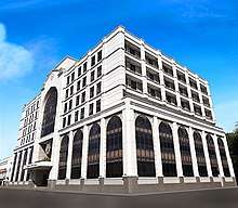
The district is the home to the main government building of the Province of Iloilo, the Iloilo provincial capital and the seat of the city government, the Iloilo City Hall. Other main agencies of the government is also located at the city proper. Its main thoroughfares are J.M. Basa St. (Calle Real), Iznart St., Gen. Luna St. and Ledesma St. It has the most service and commercial establishments among all districts.
Gallery
 A scene at Iznart Street during a Chinese new year parade
 Construction of the new Iloilo City Hall
 San José de Placer Church fronting Plaza Libertad
 Plaza Libertad
References
| Wikimedia Commons has media related to City Proper, Iloilo City. |
- National Statistics Office. "2010 Census of Population and Housing — Western Visayas". pp. 100–104.
- "Archived copy". Archived from the original on January 21, 2012. Retrieved February 20, 2012.CS1 maint: archived copy as title (link)