Illinois Route 149
Illinois Route 149 is an east–west state road in southern Illinois. It runs from Illinois Route 3 near Grimsby east to Illinois Route 34 in Thompsonville. This is a distance of 45.92 miles (73.90 km).[1]
| ||||
|---|---|---|---|---|
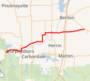
IL 149 highlighted in red | ||||
| Route information | ||||
| Maintained by IDOT | ||||
| Length | 45.92 mi[1] (73.90 km) | |||
| Existed | 1926[2]–present | |||
| Major junctions | ||||
| West end | ||||
| East end | ||||
| Location | ||||
| Counties | Jackson, Williamson, Franklin | |||
| Highway system | ||||
| ||||

Route description
Illinois 149 runs east–west through downtown Murphysboro and to the north of Carbondale. It also runs to the north of Herrin. West of Carbondale, Illinois 149 overlaps Illinois Routes 13 and 127. Through West Frankfort, Illinois 149 doubles as "Main Street."
History
SBI Route 149 originally ran from Hurst to Thompsonville. On April 1, 1963, IL 149 was extended 21 miles (34 km) east over IL 144.[3]
Major intersections
| County | Location | mi[4] | km | Destinations | Notes |
|---|---|---|---|---|---|
| Jackson | | 0.0 | 0.0 | ||
| Murphysboro | 8.1 | 13.0 | West end of IL 127 overlap | ||
| 8.3 | 13.4 | West end of IL 13 overlap | |||
| 9.2 | 14.8 | East end of IL 13 / IL 127 overlap | |||
| De Soto | 15.3 | 24.6 | |||
| Franklin | | 25.9 | 41.7 | ||
| Zeigler | 29.0 | 46.7 | |||
| West Frankfort | 35.5 | 57.1 | Exit 65 (I-57) | ||
| 36.2 | 58.3 | ||||
| Thompsonville | 45.92 | 73.90 | |||
1.000 mi = 1.609 km; 1.000 km = 0.621 mi
| |||||
gollark: Roblox devs aren't everyone.
gollark: And?
gollark: Maybe people don't know of it, or maybe they just find it bad style, but it's quite uncommon, at least.
gollark: I don't see it commonly used.
gollark: Well, it's not as if everyone knows it.
References
- Illinois Technology Transfer Center (2006). "T2 GIS Data". Retrieved 2007-11-08.
- Carlson, Rich. Illinois Highways Page: Routes 141 through 160. Last updated April 15, 2005. Retrieved June 28, 2006.
- "Rt. 144 to Become Extension of Rt. 149". Southern Illinoisan. March 31, 1961. p. 2. Retrieved November 4, 2015 – via Newspapers.com.

- Google (March 6, 2017). "Overview Map of IL 149" (Map). Google Maps. Google. Retrieved March 6, 2017.
This article is issued from Wikipedia. The text is licensed under Creative Commons - Attribution - Sharealike. Additional terms may apply for the media files.