Idaho State Highway 4
State Highway 4 (SH-4) is a state highway in Shoshone County, in the U.S. state of Idaho. It runs 7.380 miles (11.877 km) from Interstate 90 (I-90) in Wallace, east to the ghost town of Burke.[1]
| ||||
|---|---|---|---|---|
| Burke Road, Burke-Canyon Creek Road | ||||
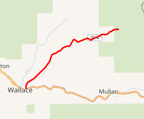
SH-4 highlighted in red | ||||
| Route information | ||||
| Maintained by ITD | ||||
| Length | 7.380 mi[1] (11.877 km) | |||
| Major junctions | ||||
| West end | ||||
| East end | ||||
| Location | ||||
| Counties | Shoshone | |||
| Highway system | ||||
| ||||

Route description
SH-4 begins at an intersection with I-90 in Wallace, then heads generally northeast through Burke Canyon, past historical markers for Frisco Hill and Burke, ending in Burke. The road continues eastward as National Forest Road No. 7623.[1][2]
History
In the 1930s, Route 4 was envisioned as a cross-state route, to directly connect Wallace to Thompson Falls, Montana over Glidden Pass, as seen on the 1937 map (later routed over Cooper Pass).[3] This plan was abandoned due to impassable roads and World War II. Paved SH-4 was truncated at Burke.
National Forest Road 7623 still connects Burke to Montana Secondary Highway 471 leading to Thompson Falls.
Major intersections
The entire route is in Shoshone County.
| Location | mi[1] | km | Destinations | Notes | |
|---|---|---|---|---|---|
| Wallace | 0.000 | 0.000 | I-90 exit 62; western terminus. | ||
| Burke | 7.380 | 11.877 | Eastern terminus; continues as FR 7623 | ||
| 1.000 mi = 1.609 km; 1.000 km = 0.621 mi | |||||
See also
References
- Idaho Transportation Department (November 26, 2008). "Milepost Log". Archived from the original on December 13, 2012. Retrieved 2008-12-27.
- Idaho Transportation Department (May 26, 2005). "Idaho Highway Historical Marker Guide Index". Archived from the original on December 15, 2008. Retrieved 2008-12-27.
- Texaco; Rand McNally and Company (1937). Road map: Idaho, Mont., Wyo (Map). Chicago: Rand McNally.
External links
![]()