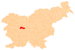
Hruševo
Hruševo (pronounced [ˈxɾuːʃɛʋɔ]) is a settlement northeast of Dobrova in the Municipality of Dobrova–Polhov Gradec in the Upper Carniola region of Slovenia.[2] It includes the hamlets of Log, Selo, and Na Govcu.[3] Hruševnik Creek flows through the valley south of the main part of Hruševo, and then separates this and Log from Selo and Na Govcu before joining the Gradaščica River.
Hruševo | |
|---|---|
View of Hruševo from the south, showing the hamlet of Log | |
 Hruševo Location in Slovenia | |
| Coordinates: 46°4′12.83″N 14°23′59.24″E | |
| Country | |
| Traditional region | Upper Carniola |
| Statistical region | Central Slovenia |
| Municipality | Dobrova–Polhov Gradec |
| Area | |
| • Total | 2.5 km2 (1.0 sq mi) |
| Elevation | 318.7 m (1,045.6 ft) |
| Population (2002) | |
| • Total | 371 |
| [1] | |
Name
The name Hruševo is derived from the Slovene word hruška 'pear' and, like similar names (e.g., Hruševica, Hruševka, Hruševje), originally referred to the local vegetation.[4] In the past it was known as Hruschowa in German.[5]
Cultural heritage
The local church, dedicated to Saint George, stands on Oprtice Hill (413 m) to the north of the main settlement. It dates from the late eighteenth century. The previous church stood at a lower location in the center of the village and was greatly damaged during a Turkish attack in 1476.[6] The church contains a painting of John of Nepomuk by Janez Valentin Metzinger from 1749 and a painting of Philip Neri by the Italian painter Michelangelo Ricciolino.[7]
Second World War
On 7 May 1942 a Slovenian National Guard (Narodna zaščita) unit ambushed a motorized Italian convoy from the Granatieri di Sardegna Mechanized Brigade in Hruševo, resulting in 33 dead and 82 wounded Italian soldiers and officers. This was the deadliest attack against Italian forces in Slovenia until that time. The same month the Italians burned part of the village.[3] In November 1942 the Partisans murdered nine members of the Hudnik family in revenge for sheltering a deserter, whom they also killed. The family was buried in a mass grave above nearby Babna Gora.[8][9] On 12 March 1943 the Partisans set the village church on fire and attempted to dynamite the bell tower, but the fuse was destroyed by two local farmers.[8][10]
Economy
The economy of the village is traditionally tied to production of potatoes, grain, beef, and milk.[3]
References
- Statistical Office of the Republic of Slovenia
- Dobrova–Polhov Gradec municipal site Archived 16 January 2014 at the Wayback Machine
- Savnik, Roman (1971). Krajevni leksikon Slovenije, vol. 2. Ljubljana: Državna založba Slovenije. pp. 412–413.
- Snoj, Marko. 2009. Etimološki slovar slovenskih zemljepisnih imen. Ljubljana: Modrijan and Založba ZRC, pp. 164–165.
- Intelligenzblatt zur Laibacher Zeitung, no. 141. 24 November 1849, p. 21.
- Dobrova parish site (in Slovene)
- Župnija Dobrova
- Matija Škerbec. 1957. Krivda rdeče fronte. Cleveland: Author, pp. 47–48.
- Graves of the Hudnik family at Find A Grave
- Javornik, Mirko. 1944. Črne bukve: o delu komunistične osvobodilne fronte proti slovenskemu narodu. Ljubljana: Slovenski dom, pp. 165–166.
External links

- Hruševo on Geopedia
