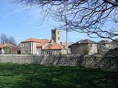
Hornby, Richmondshire
Hornby is a small village and civil parish located about 4 miles (6.4 km) north-west of Bedale. It is part of the non-metropolitan district of Richmondshire in the shire county of North Yorkshire, England.[2][3] The name of the village derives from Old Norse meaning the farm belonging to Horni.[4]
| Hornby | |
|---|---|
 The village of Hornby and the Church of Saint Mary | |
 Hornby Location within North Yorkshire | |
| Population | 280 (Including Appleton East and West, and Arrathorne 2011 census)[1] |
| OS grid reference | SE222938 |
| Civil parish |
|
| District | |
| Shire county | |
| Region | |
| Country | England |
| Sovereign state | United Kingdom |
| Post town | Bedale |
| Postcode district | DL8 |
| Police | North Yorkshire |
| Fire | North Yorkshire |
| Ambulance | Yorkshire |
Governance
Hornby is part of the electoral ward of Hornby Castle.[3] This ward stretches north to Brough with St. Giles, with a total population of 1,766.[5]
gollark: UPDATE: it works now since apparently I can still `readAll` and `write` strings in `wb`/`rb` mode for some reason.
gollark: I'm having some bizarre issues writing some binary data to files. I'll try and put together a bit of code to demonstrate this with, but basically it seems like `\13` bytes (carriage return) are being replaced with `\10` bytes (line feed). My code is using `"w"` and `"r"` modes instead of binary mode because according to the wiki binary mode doesn't let me use `readAll` and write a whole string; do I need binary mode and is there a way around reading/writing individual bytes for this?
gollark: Wait, an automatic nether portal? Won't that run out of flint and steel or something eventually?
gollark: But I'd be interested to know what application you're working on which uses distance data.
gollark: Pocket computers, turtles or neural interfaces presumably.
References
- UK Census (2011). "Local Area Report – Hornby Parish (1170217156)". Nomis. Office for National Statistics. Retrieved 17 March 2018.
- Ordnance Survey: Landranger map sheet 99 Northallerton & Ripon (Pateley Bridge & Leyburn) (Map). Ordnance Survey. 2013. ISBN 9780319231593.
- "Ordnance Survey Election Maps". www.ordnancesurvey.co.uk. Ordnance Survey. Retrieved 3 April 2016.
- Smith, A H (1969). The place-names of the North Riding of Yorkshire. Cambridge: Cambridge University Press. p. 240. OCLC 16956730.
- UK Census (2011). "Local Area Report – Hornby Castle 2011 Census Ward (1237325135)". Nomis. Office for National Statistics. Retrieved 17 March 2018.
This article is issued from Wikipedia. The text is licensed under Creative Commons - Attribution - Sharealike. Additional terms may apply for the media files.