Hoppers Crossing railway station
Hoppers Crossing railway station is located on the Werribee line in Victoria, Australia. It serves the western Melbourne suburb of Hoppers Crossing, and opened on 16 November 1970.[2][3]
Hoppers Crossing | |||||||||||
|---|---|---|---|---|---|---|---|---|---|---|---|
 | |||||||||||
| Location | Old Geelong Road, Hoppers Crossing | ||||||||||
| Coordinates | 37°53′00″S 144°42′04″E | ||||||||||
| Owned by | VicTrack | ||||||||||
| Operated by | Metro Trains | ||||||||||
| Line(s) | Werribee | ||||||||||
| Distance | 27.67 kilometres from Southern Cross | ||||||||||
| Platforms | 2 (1 island) | ||||||||||
| Tracks | 3 | ||||||||||
| Connections | Bus | ||||||||||
| Construction | |||||||||||
| Structure type | Ground | ||||||||||
| Parking | 240 | ||||||||||
| Bicycle facilities | 8 | ||||||||||
| Disabled access | Yes | ||||||||||
| Other information | |||||||||||
| Status | Host station | ||||||||||
| Station code | HCG | ||||||||||
| Fare zone | Myki zone 2 | ||||||||||
| Website | Public Transport Victoria | ||||||||||
| History | |||||||||||
| Opened | 16 November 1970 | ||||||||||
| Rebuilt | 1983 | ||||||||||
| Electrified | Yes | ||||||||||
| Traffic | |||||||||||
| Passengers (2008-2009) | 1.133 million[1] | ||||||||||
| Passengers (2009-2010) | 1.148 million[1] | ||||||||||
| Passengers (2010-2011) | 1.296 million[1] | ||||||||||
| Passengers (2011-2012) | 1.335 million[1] | ||||||||||
| Passengers (2012-2013) | Not measured[1] | ||||||||||
| Passengers (2013-2014) | 1.357 million[1] | ||||||||||
| Services | |||||||||||
| |||||||||||
The original station was on the western side of the Old Geelong Road level crossing. After proposals were made in 1980 to overcome stationary trains blocking the level crossing,[4] the station was relocated to the eastern side of the crossing in 1983, in conjunction with the electrification of the line to Werribee.[2]
The name of the area, and of the station, arises from the fact that the family of Stephen Hopper (1832-1908) were early residents of the area. He was a railway ganger, and his wife, Elizabeth, was employed to operate the gates at the level crossing adjacent to where the station is now located.[5]
The Western standard gauge line, which runs between Melbourne and Adelaide, passes to the north of Platform 1.
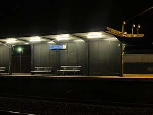
Platforms & services
Hoppers Crossing has one island platform with two faces. It is served by Metro Trains' Werribee line trains.[6]
Platform 1:
- Werribee line: all stations and limited stops services to Flinders Street
Platform 2:
- Werribee line: all stations services to Werribee
Transport links
CDC Melbourne operates seven routes to and from Hoppers Crossing station, under contract to Public Transport Victoria:
- 153: Williams Landing station – Werribee station[7]
- 160: to Tarneit station[8]
- 161: to Werribee station[9]
- 166: to Wyndham Vale station[10]
- 167: to Tarneit station[11]
- 181: to Werribee station[12]
- 498: to Laverton station[13]
References
- "Train Station Patronage FY2008-2014". Public Transport Victoria. 14 May 2015. Archived from the original (XLS) on 30 March 2016. Retrieved 1 November 2016. (access from Archived 3 November 2016 at the Wayback Machine)
- Hoppers Crossing Vicsig
- Hoppers Crossing Station Rail Geelong
- "Works". Newsrail. Australian Railway Historical Society. July 1980. p. 160.
- "John & Stephen Hopper emigrate to Australia – 1856". The Willis Tree. Archived from the original on 18 February 2013. Retrieved 6 August 2012.
- "Werribee Line". Public Transport Victoria.
- "153 Williams Landing Station - Werribee Station via Princes Hwy". Public Transport Victoria.
- "160 Hoppers Crossing Station - Tarneit Station via Morris Rd". Public Transport Victoria.
- "161 Hoppers Crossing Station - Werribee Station via Werribee Plaza SC". Public Transport Victoria.
- "166 Hoppers Crossing Station - Wyndham Vale Station via Werribee Plaza SC". Public Transport Victoria.
- "167 Hoppers Crossing Station - Tarneit Station via Werribee Plaza SC". Public Transport Victoria.
- "181 Werribee Station - Hoppers Crossing Station via Werribee Plaza SC". Public Transport Victoria.
- "498 Laverton Station - Hoppers Crossing Station via Dunnings Rd". Public Transport Victoria.
External links
- Melway map at street-directory.com.au