Hooker Glacier (New Zealand)
Hooker Glacier is one of several glaciers close to the slopes of Aoraki / Mount Cook in the Southern Alps of New Zealand.[4] It is not as large as its neighbour, the Tasman Glacier, measuring 11 kilometres (roughly 6–7 miles) in length.
| Hooker Glacier | |
|---|---|
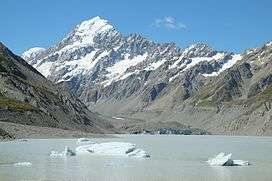
 View across glacier lake to Hooker Glacier terminus in front of Aoraki / Mount Cook | |
| Type | Mountain glacier |
| Location | New Zealand |
| Coordinates | 43°40′0″S 170°7′0″E |
| Length | 11 km (6.8 mi) |
| Thickness | 150 m (490 ft)[1] |
| Terminus | Hooker Lake[2] |
| Status | Retreating[3] |
Etymology
The geographic Hooker items were named by the Canterbury provincial geologist, Julius von Haast, after the English botanist William Jackson Hooker.[5]
Description
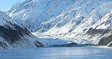
The glacier starts on the south-western slopes of Aoraki / Mount Cook, with its tributaries Sheila Glacier, Empress Glacier, and Noeline Glacier. Hooker Glacier runs south from there until its terminus at Hooker Lake. The glacial water from the lake is the source of the Hooker River, a small tributary of the Tasman River, which flows into Lake Pukaki.

One of New Zealand's more accessible glaciers, the glacier and its terminus can be seen clearly from the end of the Hooker Valley Track.[6] This easy walk to the glacier lake is the most popular in the region.[7]
For serious trampers and mountaineers, there are three huts along the glacier further up the valley: Hooker Hut, Gardiner Hut, and Empress Hut.
The current glacier lake only started to form in the 1970s, left behind as Hooker Glacier retreated. Like many of the glaciers in the Southern Alps, Hooker Glacier is rapidly melting, with the glacier lake projected to grow as the terminus retreats until it reaches the glacier bed about 4 kilometres upstream from the current terminus.[3]
See also
References
| Wikimedia Commons has media related to Hooker Glacier. |
- "A geophysical study of the termini of the Mount Cook National Park glaciers". University of Auckland. Retrieved 25 August 2016.
- "Hooker Lake, Canterbury - NZ Topo Map". NZ Topo Map. Land Information New Zealand. Retrieved 25 August 2016.
- "Rapid melting of the terminal section of the Hooker Glacier". University of Auckland. Retrieved 25 August 2016.
- "Place name detail: Hooker Glacier (New Zealand)". New Zealand Gazetteer. Land Information New Zealand. Retrieved 24 March 2009.
- "Hooker Valley". New Zealand Geographic. March–April 2011. Retrieved 20 April 2020.
- Michael J. Hambrey (1994). Glacial environments. UCL Press. ISBN 1-85728-005-9.
- "Aoraki / Mount Cook village walking tracks". Department of Conservation. Retrieved 25 August 2016.