Hogrän
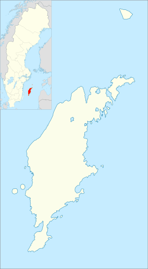
Hogrän (Swedish pronunciation: [ˈhûːɡrɛːn])[2] is a populated area, a socken (not to be confused with parish), on the Swedish island of Gotland.[3] It comprises the same area as the administrative Hogrän District, established on 1 January 2016.[4]
Hogrän | |
|---|---|
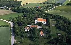
 Hogrän Church and the surrounding landscape in central Hogrän | |
 Hogrän | |
| Coordinates: 57°30′16″N 18°18′28″E | |
| Country | Sweden |
| Province | Gotland |
| County | Gotland County |
| Municipality | Gotland Municipality |
| Area | |
| • Total | 22.18 km2 (8.56 sq mi) |
| Time zone | UTC+1 (CET) |
| • Summer (DST) | UTC+2 (CEST) |
Geography
Hogrän is situated in the central inland of Gotland. The land is mainly flat farmlands mixed with meadows in the east part and forests and mires in the west. Most noted is Prostarve Änge where wild orchids grow.[5][6]
The medieval Hogrän Church is located in the socken.[7] As of 2019, Hogrän Church belongs to Vall-Hogrän-Atlingbo parish in Eskelhems pastorat, along with the churches in Vall and Atlingbo.[8][9]
History
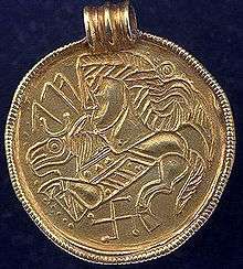
A cache containing 23 sausage-shaped Viking Age bronze ingots were found in Hogrän. The find that also contained a penannular brooch and a pin. The find is called the Stora Enbjänne find, after the farm it was found on. In 1924, it was appropriated by Swedish History Museum in Stockholm where it is now kept. Several other finds have been made in the vicinity of Stora Enbjänne. Among these are a gold bracteate, a pot or silver coins, brooches, bracelets and weights. Traces and remnants from metal working have also been found.[10][11][12][13][14]

References
- Carlquist, Gunnar, ed. (1947–1955). "Hogrän". Svensk Uppslagsbok (in Swedish) (2nd ed.). Malmö: Förlagshuset Norden.
- Jöran Sahlgren; Gösta Bergman (1979). Svenska ortnamn med uttalsuppgifter (in Swedish). p. 11.
- The exact extent of the socken, now district, can be obtained by clicking on Kartinställningar and check the Socken box in the menu of this map from the Swedish National Heritage Board database.
- "Förordning om district" [Regulation of districts] (PDF). Ministry of Finance. 17 June 2015. Retrieved 6 January 2019.
- "Hogrän". www.ne.se. Nationalencyklopedin. Retrieved 6 January 2019.
- Enderborg, Bernt. "Prostarve äng". www.guteinfo.com. Guteinfo. Retrieved 6 January 2019.
- Lagerlöf, Erland; Svahnström, Gunnar (1973). Gotlands kyrkor [Gotland's Churches] (in Swedish). Stockholm: Rabén & Sjögren. pp. 182–183. ISBN 91-29-41035-5. SELIBR 7232718.
- "Församlingar på Gotland". www.svenskakyrkan.se. Church of Sweden. Retrieved 12 January 2019.
- "Visby stifts indelning 2018". www.svenskakyrkan.se. Church of Sweden. Retrieved 12 January 2019.
- "Stora Enbjänne, Kamänget (SHM 17612)". www.historiska.se. Swedish History Museum. Retrieved 6 January 2019.
- "Stora Enbjene (SHM 6821)". www.historiska.se. Swedish History Museum. Retrieved 6 January 2019.
- "Stora Enbjänne (SHM 24301)". www.historiska.se. Swedish History Museum. Retrieved 6 January 2019.
- "Stora Enbjenne, Utängsåker (SHM 1413)". www.historiska.se. Swedish History Museum. Retrieved 6 January 2019.
- "RAÄ-nummer Hogrän 62:1". www.raa.se. Swedish National Heritage Board. Retrieved 6 January 2019.
External links

- Objects from Hogrän at the Digital Museum by Nordic Museum
