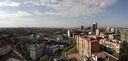
Hispanoamérica
Hispanoamérica is an administrative neighborhood (barrio) of Madrid belonging to the district of Chamartín.
Hispanoamérica | |
|---|---|
 | |
 | |
| Country | Spain |
| Region | Community of Madrid |
| Municipality | Madrid |
| District | Chamartín |
| Area | |
| • Total | 1.707406 km2 (0.659233 sq mi) |
| Population (2020) | |
| • Total | 32,181 |
| • Density | 19,000/km2 (49,000/sq mi) |
It has an area of 1.707406 km2 (0.659233 sq mi).[1] As of 1 March 2020, it has a population of 32,181.[2]
Several of the placenames in the neighborhood make a reference to locations in Hispanic America, including the plazas of Cuzco, Lima, Ecuador, República Dominicana and Perú, and the streets of Veracruz, Valparaíso, Oruro, Cochabamba, Potosí, Colombia, Uruguay, Nicaragua, Costa Rica, Puerto Rico and Chile.[3]
References
- Citations
- "Callejero vigente. Barrios". Ayuntamiento de Madrid.
- "Población por distrito y barrio". Ayuntamiento de Madrid. Retrieved 20 March 2020.
- Mejías Alonso 1993, pp. 290–291.
- Bibliography
- Mejías Alonso, Almudena (1993). "Un paseo «Hispanoamericano» por las calles de Madrid". Anales de Literatura Hispanoamericana. 22 (289): 289–300. ISSN 0210-4547.CS1 maint: ref=harv (link)
This article is issued from Wikipedia. The text is licensed under Creative Commons - Attribution - Sharealike. Additional terms may apply for the media files.