Hinoti Sadak
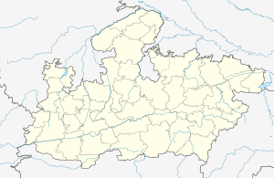
Hinoti Sadak is a village in the Bhopal district of Madhya Pradesh, India. It is located in the Berasia tehsil.[1]
Hinoti Sadak | |
|---|---|
village | |
 Hinoti Sadak  Hinoti Sadak | |
| Coordinates: 23.4901857°N 77.4099497°E | |
| Country | India |
| State | Madhya Pradesh |
| District | Bhopal |
| Tehsil | Berasia |
| Elevation | 473 m (1,552 ft) |
| Population (2011) | |
| • Total | 1,632 |
| Time zone | UTC+5:30 (IST) |
| ISO 3166 code | MP-IN |
| 2011 census code | 482301 |
Demographics
According to the 2011 census of India, Hinoti Sadak has 325 households. The effective literacy rate (i.e. the literacy rate of population excluding children aged 6 and below) is 73.81%.[2]
| Total | Male | Female | |
|---|---|---|---|
| Population | 1632 | 842 | 790 |
| Children aged below 6 years | 208 | 113 | 95 |
| Scheduled caste | 345 | 175 | 170 |
| Scheduled tribe | 55 | 28 | 27 |
| Literates | 1051 | 592 | 459 |
| Workers (all) | 658 | 437 | 221 |
| Main workers (total) | 388 | 330 | 58 |
| Main workers: Cultivators | 150 | 129 | 21 |
| Main workers: Agricultural labourers | 116 | 98 | 18 |
| Main workers: Household industry workers | 1 | 1 | 0 |
| Main workers: Other | 121 | 102 | 19 |
| Marginal workers (total) | 270 | 107 | 163 |
| Marginal workers: Cultivators | 106 | 42 | 64 |
| Marginal workers: Agricultural labourers | 154 | 58 | 96 |
| Marginal workers: Household industry workers | 0 | 0 | 0 |
| Marginal workers: Others | 10 | 7 | 3 |
| Non-workers | 974 | 405 | 569 |
gollark: You probably could just wait, given the likely failure of the shield projector eventually.
gollark: I need some of that.]
gollark: I would prefer you to not nuke my plot, thanks.
gollark: Can't you find the location of certain types of block somehow?
gollark: I do, at least, know where the projector is (to within an accuracy of probably ~3 blocks) relative to the fusion core.
References
- Lok Seva Kendra, Berasia
- "District Census Handbook - Bhopal" (PDF). 2011 Census of India. Directorate of Census Operations, Madhya Pradesh. Retrieved 20 July 2015.
This article is issued from Wikipedia. The text is licensed under Creative Commons - Attribution - Sharealike. Additional terms may apply for the media files.