Hindustan, Indiana
Hindustan is an unincorporated community in Washington Township, Monroe County, in the U.S. state of Indiana.[3]
Hindustan, Indiana | |
|---|---|
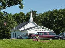 Hindustan Christian Church | |
 Hindustan  Hindustan | |
| Coordinates: 39°18′29″N 86°29′00″W | |
| Country | United States |
| State | Indiana |
| County | Monroe |
| Township | Washington |
| Elevation | 853 ft (260 m) |
| Time zone | UTC-5 (Eastern (EST)) |
| • Summer (DST) | UTC-4 (EDT) |
| ZIP code | 47408 |
| Area code(s) | 812, 930 |
| FIPS code | 18-34042[2] |
| GNIS feature ID | 436233 |
History
Hindustan was platted in August 18, 1853 by Charles G. Carr.[4][5] The community took its name after India (Hindustan) "...or a region of it."[6]
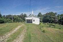
Photo from Small Town Indiana photo survey.
Geography
Hindustan is located at 39°18′29″N 86°29′00″W at an altitude of 271 metres (892 feet)[7] along Old State Road 37 between Chambers Pike and Farr Road. It is within the Morgan Monroe State Forest.
gollark: Have some || 🐝.
gollark: No, I mean do *you* have ideææææææææææææææææ?
gollark: Ideæææææ?
gollark: Are you actually on this "minecraft" game, also?
gollark: <@!332271551481118732> <@!332271551481118732> <@!332271551481118732> <@!332271551481118732> <@!332271551481118732> <@!332271551481118732> <@!332271551481118732> <@!332271551481118732> <@!332271551481118732>
References
- "US Board on Geographic Names". United States Geological Survey. October 25, 2007. Retrieved 2017-05-09.
- "U.S. Census website". United States Census Bureau. Retrieved 2008-01-31.
- "Hindustan, Indiana". Geographic Names Information System. United States Geological Survey. Retrieved 2009-10-17.
- History of Lawrence and Monroe Counties, Indiana: Their People, Industries, and Institutions. B.F. Bowen. 1914. pp. 436.
- Blanchard, Charles (1884). Counties of Morgan, Monroe and Brown, Indiana: Historical and Biographical. F.A. Battey & Company. pp. 531.
- Baker, Ronald L. (October 1995). From Needmore to Prosperity: Hoosier Place Names in Folklore and History. Indiana University Press. p. 165. ISBN 978-0-253-32866-3.
...named for India, or a region of it.
- Location of Hindustan - Falling Rain Genomics
Municipalities and communities of Monroe County, Indiana, United States | ||
|---|---|---|
| City | Map of Indiana highlighting Monroe County | |
| Towns | ||
| Townships | ||
| CDPs | ||
| Other unincorporated communities |
| |
This article is issued from Wikipedia. The text is licensed under Creative Commons - Attribution - Sharealike. Additional terms may apply for the media files.