Herkale Airport
Herkale Airport (ICAO: HDHE) is an airstrip 7 kilometres (4 mi) northwest of the hamlet of Khôr ‘Angar in Djibouti. Khôr ‘Angar is by the Bab-el-Mandeb strait, the entrance to the Red Sea.
Herkale Airport | |||||||||||
|---|---|---|---|---|---|---|---|---|---|---|---|
| Summary | |||||||||||
| Airport type | Public | ||||||||||
| Operator | Directorate of Civil Aviation and Meteorology | ||||||||||
| Serves | Khôr ‘Angar, Djibouti | ||||||||||
| Elevation AMSL | 38 ft / 12 m | ||||||||||
| Coordinates | 12°26′30″N 43°17′30″E | ||||||||||
| Map | |||||||||||
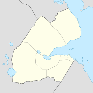
 HDHE Location of the airport in Djibouti | |||||||||||
| Runways | |||||||||||
| |||||||||||
The Assab non-directional beacon (Ident: SB) is located 53.2 nautical miles (99 km) northwest of the airstrip. The Djibouti VOR-DME (Ident: DTI) is located 55.1 nautical miles (102 km) south-southwest of the airstrip.[3][4]
Google Earth Historical Imagery (10/14/2001) shows a well-marked runway. The markings are deteriorating in the (10/25/2010) image, and gone by (5/19/2016).
References
- Google Maps - Herkale
- Airport information for Herkale Airport at Great Circle Mapper.
- "Assab NDB". Our Airports. Retrieved 19 January 2019.
- "Djibouti VOR". SkyVector. Retrieved 19 January 2019.
External links
- OurAirports - Herkale Airport
- OpenStreetMap - Herkale Airport
- FallingRain - Herkale Airport
- Accident history for HDHE at Aviation Safety Network
This article is issued from Wikipedia. The text is licensed under Creative Commons - Attribution - Sharealike. Additional terms may apply for the media files.