Hataitai
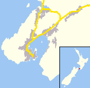
Hataitai is an inner-city suburb of Wellington, the capital of New Zealand, 3.5 kilometres southeast of the city centre. The suburb extends over the southeastern flank of Mount Victoria and down a valley between the Town Belt and a ridge along the shoreline of Evans Bay. Hataitai is bounded by Hepara Street, Grafton Road and the suburb of Roseneath in the north, Wellington Harbour in the east, Cobham Drive, Wellington Road and Crawford Road in the south, and Alexandra Road in the west.
Hataitai | |
|---|---|
Suburb | |
 Hataitai  Hataitai | |
| Coordinates: 41°18′S 174°48′E | |
| Country | New Zealand |
| Local authority | Wellington City |
| Population (2013[1]) | |
| • Total | 4,563 |
| Mount Victoria | Oriental Bay, Roseneath | |
| Mount Cook |
|
|
| Newtown | Evans Bay, Kilbirnie |
Hataitai is on important transport links between the central city and Wellington International Airport, to the south of Evans Bay on the isthmus at Rongotai. It is at the eastern end of the Mount Victoria Tunnel and the bus-only Hataitai Tunnel, built in 1907 for trams, making Hataitai a popular place to live.
Origin of name
The earliest European pioneers in Wellington knew the area that became Hataitai as "Jenkins Estate". The name Hataitai originated with the syndicate which sub-divided it for building in 1901, and derives from Whātaitai, the ancient Maori name for present-day Miramar. The ridge of the hill was thought to represent the petrified remains of the great taniwha (sea monster) Whataitai, one of the two creatures who helped form the harbour of Te Whanganui-a-Tara (Wellington Harbour). When one taniwha broke through the rock that separated the then lake from Cook Strait (the story goes), the waters rushed out, leaving Whātaitai stranded on rocks. An earthquake later lifted the monster's body into the hills below Tangi Te Keo (Mount Victoria).[2]
Settlement
Colonial settlement of the area dates from 1841, with land used mainly for farming and grazing. Robert Jenkins acquired a hundred acres of hill pasture. In order to reach it he made a road up Mount Victoria, fenced much of his land and used it for breeding horses. Population was minimal until the late 19th century. In the early days the area was part of Kilbirnie in the Evans Bay district - so the school opened in Moxham Ave in 1884 was called Kilbirnie School. In 1901 the Hataitai Land Company was formed to sell sections on the hillsides north from Waitoa Road, and the area became known as Hataitai. In 1902 the new suburb was advertised by the cutting of gigantic letters spelling 'HATAITAI' in the turf of the town side of Mount Victoria. Many of the streets in Hataitai are named after native trees: Hinau Road, Konini Road, Matai Road, Rata Road, Rewa Road etc.
Significant development took place from the early 20th century into the 1950s, spurred by improved access via the Hataitai bus tunnel (opened in 1907) and the Mt Victoria tunnel (1931). The population increased slightly between 2001 and 2006, a result of new dwellings being added to the area.
Amenities
A small shopping village is centred on Moxham Avenue and Waitoa Road. In 2011 Wellington City Council added Hataitai Village shops to its District Plan list of heritage buildings. The heritage listings mean the buildings are recognised and protected for their heritage value and any major changes to the outside of listed buildings, or demolition of them, would require resource consent. The Victorian precinct is an essential part of Wellington's fabric.
Sports facilities include the Badminton Hall on Ruahine Street and Hataitai Park on the Town Belt. Hataitai Park has a velodrome, tennis courts and rugby fields. Other community facilities include a community centre and bowling club, both of which offer venues for community activities, a medical centre, three churches (All Saints Anglican, Hataitai Methodist, Latter-day Saints) and the Treasure Grove and Waipapa Road Play Areas. In addition, the Alexandra Road Play area is accessible from Hepara Street, with a 180 degree view from Wellington Harbour's Eastbourne to Lyall Bay in the South and only a short walk to the Mount Victoria summit.
Education
Primary schools
Hataitai School is a co-educational state primary school for Year 1 to 8 students,[3][4] with a roll of 293 as of March 2020.[5]
Kilbirnie School is also a co-educational state primary school for Year 1 to 6 students,[6][7] with a roll of 185.[8]
Other education
The nearest intermediate school is Evans Bay Intermediate School in Kilbirnie.[9]
The nearest secondary school is Rongotai College in Rongotai.[9]
The suburb also has a Playcentre and two kindergartens.
References
- 2013 Census QuickStats about a place : Hataitai North
- Historic Matiu/Somes Island New Zealand Department of Conservation
- "Hataitai School Official School Website". hataitai.school.nz.
- "Hataitai School Education Review Office Report". ero.govt.nz. Education Review Office.
- "Hataitai School Ministry of Education School Profile". educationcounts.govt.nz. Ministry of Education.
- "Kilbirnie School Official School Website". kilbirnie.school.nz.
- "Kilbirnie School Education Review Office Report". ero.govt.nz. Education Review Office.
- "Kilbirnie School Ministry of Education School Profile". educationcounts.govt.nz. Ministry of Education.
- "Find schools in Wellington City". educationcounts.govt.nz. Ministry of Education.