Harshaville, Ohio
Harshaville, Ohio (also known as Harshasville[1]) is an unincorporated community in Adams County, Ohio, USA, in the southern part of the state.
Harshaville, Ohio | |
|---|---|
 Harshaville, Ohio | |
| Coordinates: 38°54′29″N 83°32′40″W | |
| Country | United States |
| State | Ohio |
| County | Adams |
| Elevation | 725 ft (221 m) |
| Time zone | UTC-5 (Eastern (EST)) |
| • Summer (DST) | UTC-4 (EDT) |
| Area code(s) | 937, 326 |
| GNIS feature ID | 1064803[1] |
Harshaville was built up around the early Harsha Mill, a gristmill powered by the Cherry Fork Creek.[2] The community was named for the local Harsha family.[3] A post office was established at Harshaville in 1865, and remained in operation until 1909.[4]
It is the location of Harshaville Covered Bridge, a historic bridge that is listed on the National Register of Historic Places.
Gallery
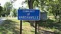 Harshaville community sign
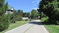 Looking east on Graces Run Road in Harshaville
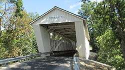 Harshaville Covered Bridge
gollark: 3. Rust
gollark: Google it.
gollark: Ah.
gollark: Just interpret it line by line or find out some other solution.
gollark: What exactly do you want to do?
References
- "Locust Grove". Geographic Names Information System. United States Geological Survey.
- Evans, Nelson Wiley (1900). A History of Adams County, Ohio: From Its Earliest Settlement to the Present Time. E B. Stivers. pp. 453.
- Ohio Historic Places Dictionary. North American Book Dist LLC. 2008. p. 3. ISBN 978-1-878592-70-5.
- "Adams County". Jim Forte Postal History. Retrieved 12 December 2015.
Municipalities and communities of Adams County, Ohio, United States | ||
|---|---|---|
| Villages | 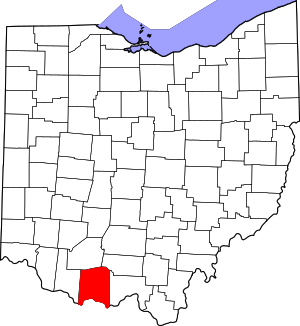 Map of Ohio highlighting Adams County | |
| Townships | ||
| CDPs | ||
| Unincorporated communities |
| |
This article is issued from Wikipedia. The text is licensed under Creative Commons - Attribution - Sharealike. Additional terms may apply for the media files.