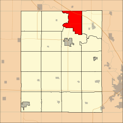
Harrison Township, Benton County, Iowa
Harrison Township is one of twenty townships in Benton County, Iowa, USA. As of the 2000 census, its population was 354.[1]
Harrison Township | |
|---|---|
 Location in Benton County | |
| Coordinates: 42°15′12″N 91°59′19″W | |
| Country | |
| State | |
| County | Benton |
| Area | |
| • Total | 70.07 km2 (27.05 sq mi) |
| • Land | 68.81 km2 (26.57 sq mi) |
| • Water | 1.25 km2 (0.48 sq mi) 1.78% |
| Elevation | 247 m (810 ft) |
| Population (2000) | |
| • Total | 354 |
| • Density | 5.1/km2 (13.3/sq mi) |
| Time zone | UTC-6 (CST) |
| • Summer (DST) | UTC-5 (CDT) |
| ZIP code | 52349 |
| GNIS feature ID | 0468010 |
History
Harrison Township was founded in 1849.[2]
Geography
According to the United States Census Bureau, Harrison Township covers an area of 27.05 square miles (70.07 square kilometers); of this, 26.57 square miles (68.81 square kilometers, 98.2 percent) is land and 0.48 square miles (1.25 square kilometers, 1.78 percent) is water.
Adjacent townships
- Jefferson Township, Buchanan County (north)
- Homer Township, Buchanan County (northeast)
- Polk Township (east)
- Taylor Township (south)
- Cedar Township (west)
Cemeteries
The township contains Bear Creek Cemetery.
Major highways
Landmarks
- Minne Estema Park
- Mount Auburn Bridge Park
School districts
- Independence Community School District
- Vinton-Shellsburg Community School District
Political districts
- Iowa's 1st congressional district
- State House District 75
- State Senate District 38
gollark: Ah yes, very acronymical.
gollark: There are optimizations you could make to this. So many optimizations.
gollark: My really lazy networking algorithms™ (ideas mostly stolen from rednet, to be honest...) work by just broadcasting a packet to every computer and having them *re*broadcast it, but dropping ones with a UUID they've already seen recently.
gollark: What is this "tharp"?
gollark: `event.listen`
References
- United States Census Bureau 2007 TIGER/Line Shapefiles
- United States Board on Geographic Names (GNIS)
- United States National Atlas
- "U.S. Census website". Retrieved 2009-05-07.
- The History of Benton County, Iowa, Containing a History of the County, Its Cities, Towns, &c. Western Historical. 1878. pp. 312.
External links
| Wikimedia Commons has media related to Harrison Township, Benton County, Iowa. |
This article is issued from Wikipedia. The text is licensed under Creative Commons - Attribution - Sharealike. Additional terms may apply for the media files.