Harbord streetcar line
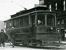
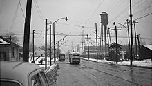
The Harbord streetcar line was an east-west line within the Toronto streetcar system. The route was named after Harbord Street even though only a small portion of the route was along the namesake street. One distinct characteristic of the route was its zip-zag nature, making many 90-degree turns onto the various streets along its route. The route was retired in 1966 when the Toronto Transit Commission (TTC) opened the Bloor–Danforth subway line (today Line 2 Bloor–Danforth), the city's first east-west subway line.[1][2][3]
_DANFORTH_HARBOR_car_crossing_Bay_St._on_Dundas%2C_downtown_Toronto%2C_ONT_on_September_8%2C_1965_(22556459266).jpg)
Evolution of the route

Prior to the creation of the TTC in 1921, the Toronto Railway Company had a 30-year franchise to operate streetcar services in Toronto, and it was the TRC that established streetcar service on Harbord Street.[2]
Between 1910 and 1911, the TRC constructed tracks on Harbord Street between Spadina Avenue and Ossington Avenue. During that same period, the TRC laid tracks on Adelaide Street between Church Street and Spadina Avenue, and on Ossington Avenue between Harbord Street and Bloor Street. Thus, in 1911, the first version of the Harbord route came into operation from Church Street, west on Adelaide Street, north on Spadina Avenue, west on Harbord Street and north on Ossington Avenue to Bloor Street.[4]:28
In 1915, the TRC extended the Harbord route north of Bloor Street running north on Ossington Avenue, west on Hallam Street, north on Dufferin Street, west on Lappin Avenue to Lansdowne Avenue.[4]:30 There was a wye at the western end of the route at Lapin and Lansdowne avenues. At the eastern end streetcars looped from eastbound on Adelaide Street, north on Victoria Street, west on Richmond Street, south on Church Street returning to Adelaide Street westbound.[5] This became the route that the TTC would inherit in 1921, when the TRC's franchise expired.[2]
On February 22 1923, the TTC extended the Harbord route from Lapin Avenue, north on Lansdowne Avenue to the new Royce Loop at the south-east corner of Royce Avenue (today Dupont Street) and Lansdowne Avenue.[2][5]

Starting October 23, 1927, the TTC had two versions of the Harbord route, one for Monday through Saturday with the eastern terminal at Adelaide and Church streets, and a substantially different route for Sundays. Both versions shared a common path west of Spadina Avenue. The eastbound Sunday route went south on Spadina Avenue, east on Dundas Street, north on Broadview Avenue, east on Gerard Street, north on Carlaw Avenue, east on Riverdale Avenue, north on Pape Avenue ending at the Lipton Loop at Lipton Avenue, one block north of Danforth Avenue.[2][5]
On April 3, 1933, the aforementioned Sunday route also became the Monday-to-Saturday route, and Harbord streetcars would not terminate at Adelaide and Church streets. The complete route from west to east from Royce Loop, south on Lansdowne Avenue, west on Lappin Avenue, south on Dufferin Street, east on Hallam Street, south on Ossington Avenue, east on Harbord Street, south on Spadina Avenue, east on Dundas Street, north on Broadview Avenue, east on Gerrard Street, north on Carlaw Avenue, east on Riverdale Avenue and north on Pape Avenue to Lipton Loop. Between the end loops, the route traveled on some portion of thirteen different streets, making 90-degree turns between each pair of streets. At that time, the Dundas streetcar route served only Dundas Street West, leaving Dundas Street East to be served by the Harbord streetcar.[2]

On December 8, 1945, the western terminal of the Harbord route was changed from Royce Loop to Townsley Loop, one block north of St. Clair Avenue, thus lengthening the western end of the route. With the expansion of trolley bus service, the Davenport streetcar was being replaced by the Ossington trolley bus on Ossington Avenue south of College Street, and by the Harbord streetcar north of Bloor Street. Streetcar service on Hallam Street and Lippin Avenue became redundant because of proximity to the Annette trolley bus line. Using pre-existing track, the revised western portion of the Harbord route ran from Ossington Avenue, west on Bloor Street, north on Dovercourt Road, west on Davenport Road, north on Old Weston Road to the Townsley Loop.[2][5]
For 10 days starting on November 19, 1956, day-time service on the western end of the Harbord route was cut back from Townsley Loop to a new St. Clarins Loop at St. Clarens Avenue and Davenport Road (south-east corner) under an Ontario Hydro right-of-way. This temporary cutback was for watermain maintenance.[2]
On January 21, 1957, the western end of the Harbord route was permanently cut back to the St. Clarins Loop. A bus loop had been added to the St. Clarins Loop. The City of Toronto wanted to replace the level crossing on Davenport Road between Caledonia Park Road and Wiltshire Avenue with an underpass. Until then, the level crossing had carried the tracks of the Harbord route. Tracks were never relaid in the new Davenport railway underpass. With this change, only the tracks on Bathurst Street would connect the St. Clair streetcar line to the rest of the Toronto streetcar system.[2][5]
Last years
With the removal of tracks from the Davenport railway level crossing in January 1957, the Harbord route entered its final form. The route from east to west ran from Lipton Loop (Pape Avenue and Lipton Avenue, just north of Danforth Avenue), south on Pape Avenue, west on Riverdale Avenue, south on Carlaw Avenue, west on Gerrard Street, south on Broadview Avenue, west on Dundas Street, north on Spadina Avenue, west on Harbord Street, north on Ossington Avenue, west on Bloor Street, north on Dovercourt Road, west on Davenport Road to St. Clarins Loop at St. Clarens Avenue.[2][5]
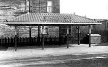
Circa 1962, the Lipton Loop had to be modified to accommodate construction of Pape station on the Bloor–Danforth subway line. Streetcars entered the old loop via Lipton Avenue and ran counter-clockwise exiting near the south side of the building at 749 Pape Avenue. The new loop was slightly to the north of the old loop. Streetcars entered from Pape Avenue on the south side of the aforementioned building, turned through a lane on the east side of the building and exited on Gertrude Place to return to Pape Avenue.[2]
The last day for the Harbord route was February 25, 1966, the day before the opening of the Bloor–Danforth subway line (today Line 2 Bloor–Danforth). Harbord was one of five streetcar routes abandoned with the opening of the subway; the others were Bloor, Fort (partly replaced by today's 511 Bathurst, Parliament and Coxwell.[6]:107–113
Surface routes were modified or created to serve former Harbord stops. The 72 Pape bus covered the route from Pape Street to Gerrard Street. The Dundas streetcar (today 505 Dundas) was extended onto Dundas Street East and then north on Broadview Avenue to Broadview station. Harbord Street was covered by the 94 Wellesley bus which connected to Ossington station. Various bus routes evolved to cover the Harbord route north of Bloor Street.[2]
Abandoned extension
When the Lipton Loop was being built in 1927, there the intention to extend the streetcar tracks further north on Pape Avenue, over the Leaside Bridge into the Leaside industrial area via Millwood Road. For this purpose, the Leaside Bridge was built reinforced with extra steel to carry streetcar traffic. Also, there were short stubs for a double track extension at the north end of Lipton Loop. No further construction occurred because of Great Depression.[7][8]
In 2019, the Province of Ontario announced the construction of the light metro Ontario Line, which would follow Pape Avenue underground from Pape Station and cross the Don Valley into Leaside. This plan has a similarity in route to the abondonned streetcar plan in that it follows Pape Avenue north of Danforth Avenue.[9]
References
-
Chris Bateman (2015-01-05). "5 lost streetcar routes in Toronto". Blog TO. Archived from the original on 2015-01-11. Retrieved 2017-12-03.
The snaking Harbord route was also the bearer of a name that did little to describe its route. Starting at Pape and Danforth, it wound its way to Gerrard and Broadview before heading west on Dundas to Spadina, then north to Harbord before ending near Davenport and Lansdowne.
- James Bow (2017-01-10). "The Harbord Streetcar (Deceased)". Transit Toronto. Retrieved 2017-12-03.
- Kenneth Springirth (2017). Toronto Streetcars Serve the City. Fonthill Media. pp. 1961, 1972. Retrieved 2017-12-03.
- Pursley, Louis H. (1958). Street Railways of Toronto: 1861–1921. Los Angeles: Interurbans Press.
- John F. Bromley and Jack May (1973). 50 Years of Progressive Transit. Electric Railroaders' Association. pp. Supplement – Maps and Charts. ISBN 9781550024487.
- John F. Bromley and Jack May (1973). 50 Years of Progressive Transit. Electric Railroaders' Association. ISBN 9781550024487.
- Munro, Steve (July 27, 2019). "The Ontario Line: Metrolinx' Initial Business Case". Steve Munro. Retrieved July 27, 2020.
- "Lipton Loop". Transit Toronto. Upper Canada Railway Society. Retrieved July 27, 2020.
- Jackson-Kelso, Rhianna; Bensadoun, Emerald (April 10, 2019). "How Doug Ford's $28.5-billion transit overhaul compares with Toronto's existing plans". Toronto Star. Archived from the original on April 11, 2019. Retrieved April 11, 2019.
External links
- Toronto streetcar trackage as of June 1921 prior to TTC takeover
- 1965 plan of TTC streetcar and trolley bus network one year before the closure of the Harbord streetcar line
- Lipton Loop track plan both before and after modification in 1962
- Harbord route history with charts showing more route variations