Hans Tausen Ice Cap
Hans Tausen Ice Cap (Danish: Hans Tausens Iskappe) is an ice cap in Peary Land, northern Greenland. Ice cores show it is around 3500–4000 years old. It formed since the Holocene climatic optimum of 6000-8000 BP.[2][3][4][5][6][7]
| Hans Tausen Ice Cap | |
|---|---|
| Hans Tausens Iskappe | |
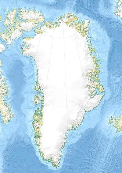 Location within Greenland | |
| Type | Ice cap |
| Location | Greenland |
| Coordinates | 82°30′N 37°30′W |
| Area | ca 4,000 km2 |
| Length | 100 km |
| Width | 80 km |
| Thickness | max 600 m |
| Status | The future development of the ice cap is highly dependent upon summer temperatures.[1] |
Geography
The ice cap is located south of the De Long Fjord area and east of Freuchen Land, across the inner J.P. Koch Fjord, and west of Odin Fjord.[8] It is about 100 km from north to south and 80 km from east to west and sits on a 1300 m high plateau.
The Hans Tausen Ice Cap is the source of many glaciers, including Ymer Glacier, Lur Glacier and the Tjalfe Glacier.[9] It is a well studied ice cap, and is important to understanding the Holocene climatic optimum.[10]
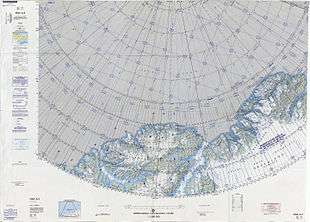 Map of Far Northern Greenland. |
gollark: You can only use C or Python, for purposes.
gollark: <@125549206139174912> Clear?
gollark: Previous rounds are here: https://ubq323.website/competition/
gollark: Your score is the number of people you guessed right minus the number of people who guessed you correctly.
gollark: You implement the challenge, submit your code to ubq323, and then wait for the guessing phase to begin, at which point you then guess who wrote each other entry.
See also
References
- Paper on ice flow PDF
- Hans Tausen Iskappe, North Greenland - Studies using an ice flow model
- http://epic.awi.de/2036/
- http://www.iceandclimate.nbi.ku.dk/publications/theses/hanstauseniskappenorthgreenland-studiesusinganiceflowmodel.pdf/
- Möller, Per; Larsen, Nicolaj K.; Kjær, Kurt H.; Funder, Svend; Schomacker, Anders; Linge, Henriette; Fabel, Derek (2010). "Early to middle Holocene valley glaciations on northernmost Greenland". Quaternary Science Reviews. 29 (25–26): 3379–3398. doi:10.1016/j.quascirev.2010.06.044.
- https://www.researchgate.net/profile/Jon_Landvik/publication/230709679_The_glacial_history_of_the_Hans_Tausen_Iskappe_and_the_last_glaciation_of_Peary_Land_North_Greenland/links/0fcfd50e0335f57e48000000.pdf
- http://meetingorganizer.copernicus.org/EGU2015/EGU2015-1540.pdf
- GoogleEarth
- http://travelingluck.com/North+America/Greenland/Nordgr%C3%B8nland/_3423569_Hans+Tausen+Iskappe.html#local_map
- Landvik et al 2001
This article is issued from Wikipedia. The text is licensed under Creative Commons - Attribution - Sharealike. Additional terms may apply for the media files.