Hanabanilla Dam
The Hanabanilla Dam is an embankment dam on the Hanabanilla River near the village of El Salto del Hanabanilla in Villa Clara Province, Cuba. The purpose of the dam is to provide water for irrigation and municipal uses and to generate hydroelectric power.
| Hanabanilla Dam | |
|---|---|
Hanabanilla Lake | |
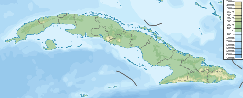
 Location of Hanabanilla Dam in Cuba | |
| Official name | Presa Hanabanilla |
| Country | Cuba |
| Location | El Salto del Hanabanilla, Villa Clara Province |
| Coordinates | 22°5′39.39″N 80°4′2.66″W |
| Purpose | Water supply, power |
| Status | Operational |
| Construction began | 1958 |
| Opening date | 1961 |
| Dam and spillways | |
| Type of dam | Embankment |
| Impounds | Hanabanilla River |
| Height | 46.5 m (153 ft) |
| Reservoir | |
| Total capacity | 286,000,000 m3 (232,000 acre⋅ft) |
| Catchment area | 192 km2 (74 sq mi) |
| Surface area | 14.9 km2 (5.8 sq mi) |
| Commission date | 1963 |
| Turbines | 3 x 14.3 MW Francis-type |
| Installed capacity | 43 MW |
Overview
The dam withholds a reservoir of 286,000,000 m3 (232,000 acre⋅ft) and the power station, located near its base, has an installed capacity of 43 MW. It is the largest hydroelectric power station in the country. Near the southern end of the reservoir is Jibacoa Dam, an auxiliary dam, which closes off one valley to create the existing large reservoir.
The dam was constructed between 1958 and 1961.[1] The power station was commissioned in 1963. In March 2014 a rehabilitation of the power station began.[2][3][4]
References
- "Lake Hanabanilla" (PDF). Cuba: Natural Tourism (in Spanish). Travel Port. 2013. Retrieved 1 May 2014.
- "In hydro repair process Hanabanilla" (in Spanish). Granma. 4 March 2014. Retrieved 1 May 2014.
- "Centrales Hidroelectricas" (PDF) (in Spanish). CUBA. Características Generales. October 2013. Retrieved 1 May 2014.
- "Environment Overview. Cuba" (PDF) (in Spanish). National Institute of Hydraulic Resources. 2012. Archived from the original (PDF) on 2 May 2014. Retrieved 1 May 2014.
External links
![]()