Hall, Gotland
Hall is a populated area, a socken (not to be confused with parish), on the Swedish island of Gotland.[3] It comprises the same area as the administrative Hall District, established on 1 January 2016.[4]
Hall | |
|---|---|
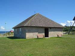
 Hallshuk fishermen chapel in Hall | |
 Hall | |
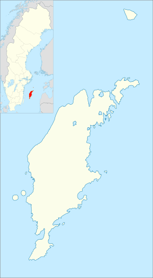
| Coordinates: 57°53′31″N 18°42′57″E | |
| Country | Sweden |
| Province | Gotland |
| County | Gotland County |
| Municipality | Gotland Municipality |
| Area | |
| • Total | 34.29 km2 (13.24 sq mi) |
| Population (2014)[2] | |
| • Total | 53 |
| Time zone | UTC+1 (CET) |
| • Summer (DST) | UTC+2 (CEST) |
Geography
Hall is situated on the north coast of Gotland.[5] The medieval Hall Church is located in the socken.[6] On the coast is also Hallshuk, sometimes called Hall, fishing village with the Hallshuk Chapel, built by Queen Christina in 1645, to be used by the fishermen working in the area.[7] As of 2019, Hall Church and Hallshuk Chapel belongs to Forsa parish in Norra Gotlands pastorat, along with the churches in Lärbro, Hellvi and Hangvar.[8][9]
Along the northwest and north coast of Hall is the Hall-Hangvar nature reserve. The reserve is the largest on Gotland, covering an area of 28 km2 (11 sq mi).[10] The reserve was established in 1967 and expanded in 1999.[11]
References
- Carlquist, Gunnar, ed. (1947–1955). "Hall socken". Svensk Uppslagsbok (in Swedish) (2nd ed.). Malmö: Förlagshuset Norden.
- "Gotland i siffror 2015" [Gotland in numbers 2015]. www.gotland.se. Gotland Municipality. Retrieved 28 August 2016.
- The exact extent of the socken, now district, can be obtained by clicking on Kartinställningar and check the Socken box in the menu of this map from the Swedish National Heritage Board database.
- "Förordning om district" [Regulation of districts] (PDF). Ministry of Finance. 17 June 2015. Retrieved 29 August 2016.
- "Hall". www.ne.se. Nationalencyklopedin. Retrieved 29 August 2016.
- Lagerlöf, Erland; Svahnström, Gunnar (1973). Gotlands kyrkor [Gotland's Churches] (in Swedish). Stockholm: Rabén & Sjögren. pp. 163–164. ISBN 91-29-41035-5. SELIBR 7232718.
- Enderborg, Bernt. "Hallshuks fiskeläge". www.guteinfo.com. Guteinfo. Retrieved 28 August 2016.
- "Församlingar på Gotland". www.svenskakyrkan.se. Church of Sweden. Retrieved 11 January 2019.
- "Visby stifts indelning 2018". www.svenskakyrkan.se. Church of Sweden. Retrieved 11 January 2019.
- Brynolf, Bertil. "Hall - Hangvar naturreservat". www.hallshuk.se. Bengt Elmerstad and Bertil Brynolf. Retrieved 28 August 2016.
- "Hall-Hangvar". www.lansstyrelsen.se. Gotland County Administrative Board. Retrieved 29 August 2016.
External links

- Objects from Hall at the Digital Museum by Nordic Museum
