Haalderen
Haalderen is a village in the Netherlands, in the province of Gelderland. It is located in the Betuwe region, between the rivers Waal and Linge.[1] The village is part of the municipality of Lingewaard.[2] It has a population of 2,061 (as of 1 January 2020).
Haalderen | |
|---|---|
Village | |
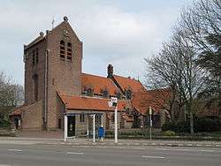 The church of Haalderen | |
 Haalderen | |
| Coordinates: 51°53′12″N 5°55′48″E | |
| Country | Netherlands |
| Province | Gelderland |
| Municipality | Lingewaard |
| Area | |
| • Total | 2.55 km2 (0.98 sq mi) |
| Elevation | 9 m (30 ft) |
| Population (2020) | |
| • Total | 2,061 |
| • Density | 810/km2 (2,100/sq mi) |
| Demonym(s) | Haaldernaar |
Landscape
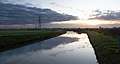
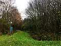
Haalderen generally contains fertile soils that lie on nutrient-rich river deposits. In the southwest of Haalderen there are floodplains of the Waal. Due to several levee breaches in the past, tree kolks (called Grote Kolk, Kleine Kolk and Groene Kolk) are still clearly visible in the current landscape of Haalderen. There is also a kolk lake in the border area of Haalderen and Bemmel (called Ronduit).
Education
The village has one primary school: De Wieling. It has about 250 pupils.
Notable residents
Notable people from Haalderen include:
- Joop Puntman (1934–2013), a Dutch ceramist and sculptor[3]
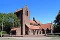
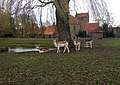
Photo gallery
_oorlogsmonument.JPG)
References
- "Haalderen Map – Netherlands Google Satellite Maps". Maplandia.com. Retrieved 5 July 2015.
- "Haalderen (Lingewaard, Gelderland, Netherlands)". Citypopulation.de. Retrieved 5 July 2015.
- "Joop Puntman Biographical Data". Netherlands Institute for Art History. Retrieved 5 July 2015.