Hit, Iraq
Hīt, also spelled Heet (Arabic: هيت), ancient name Is, is an Iraqi city in Al-Anbar province. Hīt lies northwest of Ramadi, the provincial capital.
Hīt هيت | |
|---|---|
City | |
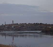 Hit in 2004 | |
 Hīt | |
| Coordinates: 33°38′42″N 42°49′35″E | |
| Country | |
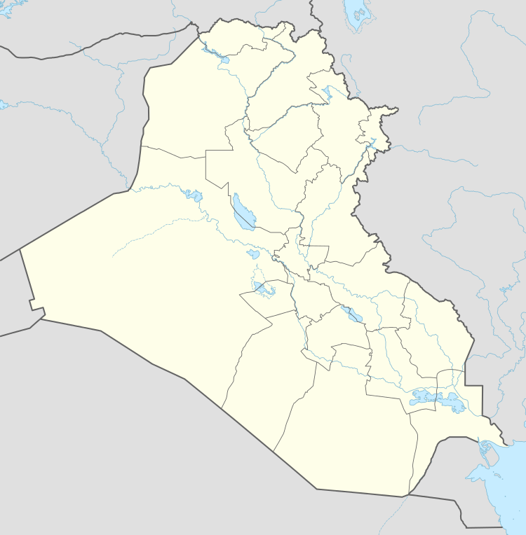
| Province | Al-Anbar |
| District | Hīt District |
| Population (2018) | |
| • Total | 66,700 |
| Time zone | UTC+3 (GMT+3) |
| Postal code | 31007 |
| Ancient name | Is |
On the Euphrates River, Hīt is a small walled town built on two mounds on the site of the ancient city of Is. In ancient times, the town was known for its bitumen wells, which were used as far back as 3,000 years ago, to include building of Babylon and for caulking boats. Hīt also became a frontier fortress for Assyria. Now, Hīt is a marketplace for agricultural produce and oil pipelines to the Mediterranean Sea cross the Euphrates there. It was regarded as the head of navigation on the river before the decline in river traffic.[1] Hit marks the beginning of the high sedimentary plain on the Euphrates,[2] and it contains a number of hot springs.[3]
Climate
Hīt has a hot desert climate (Köppen climate classification BWh). Most rain falls in the winter. The average annual temperature in Hīt is 21.9 °C (71.4 °F). About 115 mm (4.53 in) of precipitation falls annually.
| Climate data for Hīt | |||||||||||||
|---|---|---|---|---|---|---|---|---|---|---|---|---|---|
| Month | Jan | Feb | Mar | Apr | May | Jun | Jul | Aug | Sep | Oct | Nov | Dec | Year |
| Average high °C (°F) | 14.1 (57.4) |
17.7 (63.9) |
22.4 (72.3) |
28.2 (82.8) |
35.2 (95.4) |
40.3 (104.5) |
42.8 (109.0) |
42.7 (108.9) |
39.2 (102.6) |
32.5 (90.5) |
23.5 (74.3) |
16.2 (61.2) |
29.6 (85.2) |
| Average low °C (°F) | 3.2 (37.8) |
4.6 (40.3) |
8.7 (47.7) |
13.9 (57.0) |
19.1 (66.4) |
22.8 (73.0) |
25.4 (77.7) |
24.8 (76.6) |
21.0 (69.8) |
15.5 (59.9) |
9.1 (48.4) |
4.5 (40.1) |
14.4 (57.9) |
| Average precipitation mm (inches) | 15 (0.6) |
18 (0.7) |
20 (0.8) |
27 (1.1) |
1 (0.0) |
0 (0) |
0 (0) |
0 (0) |
0 (0) |
3 (0.1) |
14 (0.6) |
17 (0.7) |
115 (4.5) |
| Source: Climate-Data.org,Climate data | |||||||||||||
Gallery
.jpg) Hit, Iraq, 2004
Hit, Iraq, 2004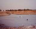 Kubaisa Oasis, 2003
References
| Wikimedia Commons has media related to Hīt. |
- "Hīt". The New Encyclopædia Britannica. V. Chicago: Encyclopædia Britannica, Inc. 1980. p. 66. Retrieved 2 November 2019.
- Ru'uf, Amad Abd al-Salam (2005). "هيت من أقدم العصور حتى الاحتلال البريطاني" [Hit from the earliest times to the British occupation]. al-Hikma (in Arabic) (39): 151.
- Abdullah, Bakr Ali (2 May 2006). "هيت منزل الآلهة ومدخل الأرض السفلى" [Hit, dwelling of the gods and entrance to the underworld]. Al-Sabah al-Jadid (in Arabic) (510).
- Ru'uf 2005, pp. 142–150.
- Aboudi, Henry (1991). معجم الحضارات السامية [A Dictionary of Semitic Civilizations] (in Arabic). Tripoli: Jurus Baras. p. 89.
- Le Strange (1905), p. 65
- Reuters (13 December 2014). "ISIL captures Anbar province town in Iraq, kills 19 police". Al Jazeera English. Al Jazeera America, LLC. Retrieved 2 November 2019.
- "Iraqi forces recapture key town from IS militants". Alaraby. 14 April 2016. Retrieved 14 April 2016.
Sources
- Le Strange, Guy (1905). The Lands of the Eastern Caliphate: Mesopotamia, Persia, and Central Asia, from the Moslem Conquest to the Time of Timur. Cambridge: Cambridge University Press. OCLC 458169031.
| ||