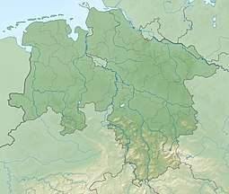
Höxterberg
The Höxterberg is a hill in the Harz Mountains of central Germany, that lies south of Sieber in the district of Göttingen in Lower Saxony. It is 584 metres high and lie 0.9 kilometres west of the Pagelsburg, 1.5 kilometres south of the Fissenkenkopf, 1.8 km west of the Großer Knollen and 1 kilometre north of the Mittelecke. The hill is mostly covered by beech woods. Towards the northwest the Höxterberg transitions into the Steile Wand.
| Höxterberg | |
|---|---|
 Höxterberg south of Sieber in Göttingen district in Lower Saxony | |
| Highest point | |
| Elevation | 584 m (1,916 ft) |
| Prominence | 84 m ↓ Jägerfleck → Großer Knollen |
| Isolation | 1.2 km → Großer Knollen |
| Coordinates | 51°40′20″N 10°24′21″E |
| Geography | |
| Location | south of Sieber in Göttingen district in Lower Saxony |
| Parent range | Harz |
Sources
- Topographische Karte 1:25000, Nr. 4328 Bad Lauterberg im Harz
gollark: I posted on it recently. Such funlolz.
gollark: Maybe TJ09 secretly only uses that.
gollark: "In my day we couldn't fog eggs and we liked it!"
gollark: "The inability to deal with sickness on traded eggs an important balance thing!"
gollark: "They're just helping your egg!"
This article is issued from Wikipedia. The text is licensed under Creative Commons - Attribution - Sharealike. Additional terms may apply for the media files.