Guía de Isora
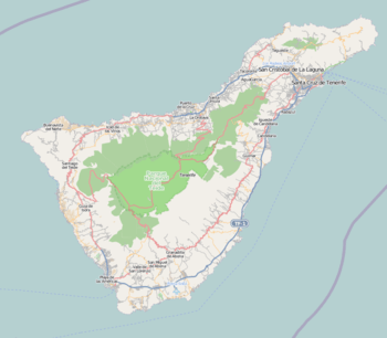
Guía de Isora is a municipality in the western part of the island of Tenerife, one of the Canary Islands, and part of the Province of Santa Cruz de Tenerife. The population is 20,537 (2013[2]), and the area is 143 km. The town Guía de Isora is 5 km from the coast, 16 km northwest of Arona and 60 km southwest of the island's capital Santa Cruz de Tenerife.
Guía de Isora | |
|---|---|
Municipality | |
 Flag  Coat of arms | |
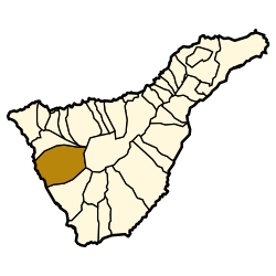 Municipal location in Tenerife | |
 Guía de Isora Location in Tenerife  Guía de Isora Guía de Isora (Canary Islands)  Guía de Isora Guía de Isora (Spain, Canary Islands) | |
| Coordinates: 28°12′40″N 16°46′50″W | |
| Country | |
| Autonomous Community | |
| Province | Tenerife |
| Island | Tenerife |
| Government | |
| • Mayor | Pedro Martín Domínguez (PSOE) |
| Area | |
| • Total | 143.4 km2 (55.4 sq mi) |
| Elevation (AMSL) | 540 m (1,770 ft) |
| Population (2018)[1] | |
| • Total | 20,991 |
| • Density | 150/km2 (380/sq mi) |
| Time zone | UTC+0 (CET) |
| • Summer (DST) | UTC+1 (CEST (GMT +1)) |
| Postal code | 38680 |
| Area code(s) | +34 (Spain) + 922 (Tenerife) |
| Climate | Csb |
| Website | www.guiadeisora.es |
Historical population
| Year | Population |
|---|---|
| 1991 | 11,915 |
| 1996 | 12,560 |
| 2001 | 14,982 |
| 2002 | 16,320 |
| 2003 | 17,163 |
| 2004 | 17,816 |
| 2013 | 20,537 |
gollark: !pr createCreate a new rule %language-a under %meta-rules:> "English" is Language A for "Language A".
gollark: Suuuuuuuuuuure.
gollark: !roll d6*3030
gollark: Well, the rules aren't technically *implemented* yet, so it's not forbidden to update them...
gollark: Wait, can I add rules now?
References
- Municipal Register of Spain 2018. National Statistics Institute.
- Instituto Canario de Estadística Archived 2014-04-16 at the Wayback Machine
Places adjacent to Guía de Isora | ||||||||||
|---|---|---|---|---|---|---|---|---|---|---|
| ||||||||||
Municipalities in the province of Santa Cruz de Tenerife | ||
|---|---|---|
| Tenerife |
| |
| La Palma |
| |
| La Gomera |
| |
| El Hierro |
| |
This article is issued from Wikipedia. The text is licensed under Creative Commons - Attribution - Sharealike. Additional terms may apply for the media files.