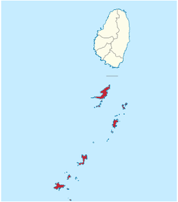
Grenadines Parish
Grenadines is an administrative parish of Saint Vincent and the Grenadines, comprising the islands of the Grenadines other than those belonging to Grenada. The capital is Port Elizabeth.
- Area: 44 km² (17 mi²)
- Population: 9,200 (2000 estimates)
Grenadines | |
|---|---|
Parish | |
 | |
| Coordinates: 13°01′N 061°14′W | |
| Country | Saint Vincent and the Grenadines |
| Capital City | Port Elizabeth |
| Area | |
| • Total | 17 sq mi (44 km2) |
| Elevation | 999 ft (304 m) |
| Population | |
| • Total | 9,200 |
Islands
The parish includes the northern Grenadine Islands:[1]
- All Awash Island (12°55′N 061°08′W)
- Baliceaux (Baliceaux Island, 12°57′N 061°08′W)
- Battowia (Battowia Island, 12°58′N 061°08′W)
- Bequia (13°01′N 061°13′W)
- Canouan (Canouan Island, 12°43′N 061°20′W)
- Catholic Island (12°40′N 061°24′W)
- Church Cay (12°57′N 061°08′W)
- Dove Cay (12°41′N 061°21′W)
- L'Islot (12°41′N 061°21′W)
- Mayreau (12°39′N 061°23′W)
- Mustique (12°53′N 061°11′W)
- Petit Canouan (12°47′N 061°17′W)
- Petit Cay (12°50′N 061°12′W)
- Petit Mustique (12°51′N 061°12′W)
- Petit Nevis (12°58′N 061°15′W)
- Petit Saint Vincent (12°32′N 061°23′W)
- Pigeon Island (12°57′N 061°17′W)
- Prune Island (Palm Island, 12°35′N 061°24′W)
- Quatre (Isle à Quatre, 12°57′N 061°15′W)
- Rabbit Island (12°51′N 061°10′W)
- Red Island (12°36′N 061°25′W)
- Saint Elairs Cay (12°59′N 061°14′W)
- Sand Cay (12°36′N 061°26′W)
- Savan (Savan Island, 12°48′N 061°12′W)
- The Pillories (Les Piloris, 12°54′N 061°10′W)
- Tobago Cays (12°38′N 061°21′W)
- Union Island (12°36′N 061°26′W)
Populated places
The following populated places are located in the parish of Grenadine:[1]
| Name | Coordinates | Island |
|---|---|---|
| Ashton | 12°35′41″N 061°26′05″W [2] | Union Island |
| Bednoe | 12°57′N 061°15′W | Quatre |
| Charlestown | 12°42′03″N 061°19′53″W [3] | Canouan |
| Cheltenham | 12°53′N 061°11′W | Mustique |
| Clifton | 12°35′45″N 061°25′07″W [4] | Union Island |
| Derrick | 12°59′N 061°15′W | Bequia |
| Dovers | 12°53′N 061°11′W | Mustique |
| Friendship | 12°59′32″N 061°14′10″W [5] | Bequia |
| Lovell Village | 12°52′57″N 061°11′16″W [6] | Mustique |
| Old Wall | 12°38′19″N 061°23′38″W [7] | Mayreau |
| Paget Farm | 12°59′17″N 061°15′11″W [8] | Bequia |
| Port Elizabeth | 13°00′40″N 061°14′04″W [9] | Bequia |
gollark: I see. I don't think it's just a thing of "they would agree with me if they had more information".
gollark: I didn't actually say that. I'm not sure what you're agreeing with.
gollark: No, I mean you said you would ignore metadiscussion outside it.
gollark: You could express opinions and discuss things *anyway*, see.
gollark: It's a slightly different discussion channel with more constraints. It isn't particularly amazing as an innovation, and it enforces a style of communication you prefer and some don't on pain of being ignored (more).
References
- "GeoNames Search". National Geospatial-Intelligence Agency. Retrieved 2 March 2013.
- "Ashton". Wikimapia. Retrieved 3 March 2013.
- "Charlestown". Wikimapia. Retrieved 3 March 2013.
- "Clifton". Wikimapia. Retrieved 3 March 2013.
- "Friendship". Wikimapia. Retrieved 3 March 2013.
- "Lovell Village". Wikimapia. Retrieved 3 March 2013.
- "Old Wall". Wikimapia. Retrieved 3 March 2013.
- "Lovell Village". Wikimapia. Retrieved 3 March 2013.
- "Port Elizabeth". Wikimapia. Retrieved 3 March 2013.
This article is issued from Wikipedia. The text is licensed under Creative Commons - Attribution - Sharealike. Additional terms may apply for the media files.