Green Valley, Minnesota
Green Valley is an unincorporated community in Fairview Township, Lyon County, Minnesota, United States.
Green Valley, Minnesota | |
|---|---|
 Green Valley Location in Minnesota  Green Valley Location in the United States | |
| Coordinates: 44°31′37″N 95°45′26″W | |
| Country | United States |
| State | Minnesota |
| County | Lyon |
| Township | Fairview |
| Elevation | 1,099 ft (335 m) |
| Time zone | UTC-6 (Central (CST)) |
| • Summer (DST) | UTC-5 (CDT) |
| ZIP code | 56258 |
| Area code(s) | 507 |
| GNIS feature ID | 644426[1] |
The community is located between the cities of Marshall and Cottonwood near the junction of Minnesota State Highway 23 (MN 23) and Lyon County State-Aid Highway 8.
History
Green Valley was platted in 1888, and named for its location in the green valley of the Redwood River.[2] A post office was established in Green Valley in 1889, and remained in operation until 1964.[3]
gollark: A web application which will applicate some webs.
gollark: An apioform is an apioform.
gollark: Well, I wanted to write a thing, and my choices are/were essentially:- Rust - kind of annoying (yes, yes, I know) since I don't care that much about performance and don't mind just waiting for the garbage collector to garbage collect- JavaScript - fast/easy for me to write, but horribly resource-inefficient and it'll probably break in a few months from dependencies- Python - I don't really like it for larger-scale things, and dependency management is still fairly bees- something else, and I'd heard OCaml was neat
gollark: Yes, I'm assuming it probably isn't, but I don't know what *is* going on.
gollark: I duckduckwent it and found a compiler bug which looked related, but it was fixed last year.
References
- "Green Valley, Minnesota". Geographic Names Information System. United States Geological Survey.
- Upham, Warren (1920). Minnesota Geographic Names: Their Origin and Historic Significance. Minnesota Historical Society. p. 313.
- "Lyon County". Jim Forte Postal History. Retrieved 18 July 2015.
- Rand McNally Road Atlas – 2007 edition – Minnesota entry
- Official State of Minnesota Highway Map – 2013/2014 edition
Municipalities and communities of Lyon County, Minnesota, United States | ||
|---|---|---|
| Cities | 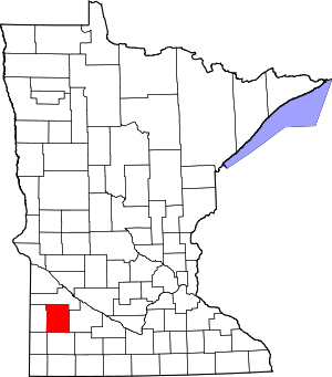 Map of Minnesota highlighting Lyon County | |
| Townships | ||
| Unincorporated communities | ||
This article is issued from Wikipedia. The text is licensed under Creative Commons - Attribution - Sharealike. Additional terms may apply for the media files.