Grand-Béréby
Grand-Béréby is a coastal town in south-western Ivory Coast. It is a sub-prefecture and commune of San-Pédro Department in San-Pédro Region, Bas-Sassandra District.
Grand-Béréby | |
|---|---|
Town, sub-prefecture, and commune | |
 Grand-Béréby Location in Ivory Coast | |
| Coordinates: 4°39′N 6°56′W | |
| Country | |
| District | Bas-Sassandra |
| Region | San-Pédro |
| Department | San-Pédro |
| Population (2014)[1] | |
| • Total | 98,686 |
| Time zone | UTC+0 (GMT) |
Grand-Béréby is located where the Néro river enters the Atlantic. A 1,010 metres (3,314 ft) unpaved airstrip serves the town.
Tourism
The city is equipped with a resort, the La Baie des sirènes[2], the Ecolodge Le Kara Krou chez Gus, à Ménéké plage, 9km to Grand Béréby.
The village of Boubélé, located 60 km to the west, in the direction of Tabou is specialized in sport fishing. Red carp, barracuda, mackerel, trevallies, skate, marlin and sharks abound in this area.
Notable people
- Jean Michaël Seri (born 19 July 1991), is an Ivorian international footballer
In 2014, the population of the sub-prefecture of Grand-Béréby was 98,686 [3].
Villages
The seventy four villages of the sub-prefecture of Grand-Béréby and their population in 2014 are [3]:
- Badiké (799)
- Dawa (245)
- Djikla (385)
- Dosso (395)
- Gboro (694)
- Grand-Béréby (9 338)
- Grand-Djourou (830)
- Hannié (710)
- Ménéké (378)
- Ménolé (1 531)
- Néro-Boupé (135)
- Néro-Mer (255)
- Nouhou Youkou (128)
- Ouro (262)
- Roc-Dougbalé (363)
- Roc-Oulidié (839)
- Takoro (580)
- Youwasso (1 785)
- Adjaméné (10 521)
- Baco 1 (705)
- Baco 2 (529)
- Baco 3 (805)
- Batcha (488)
- Bébé (150)
- Djihimbo (889)
- Dolé I (628)
- Dolé Ii (890)
- Dolé Iii (430)
- Dotou (3 112)
- Gliké (2 277)
- Gliké V4 (908)
- Gnaoula (497)
- Grand-Djoro (481)
- Gréléon (3 178)
- Héké 1 (841)
- Héké 2 (833)
- Héké 3 (722)
- Héké-Village (3 512)
- Iboké (1 737)
- Iratéké (2 556)
- Irépoué (53)
- Kablaké (479)
- Kako 1 (827)
- Kako 2 (620)
- Kako 3 (472)
- Kako-Village (6 704)
- Klana (229)
- Klotou (501)
- Koto I (727)
- Koto Ii (628)
- Koto Iii (784)
- Mani-Béréby (827)
- Nané (732)
- Néhonnié 1 (720)
- Néhonnié 2 (277)
- Néro-Brousse (2 532)
- Ouatéké (266)
- Ouéléké (1 180)
- Ouéoulo (1 741)
- Ouesséké (114)
- Oulibio (75)
- Oulidié (794)
- Oulisso (112)
- Pataké (702)
- Petit-Nado (966)
- Pitiké (255)
- Pont-Néro (2 749)
- Singhé I (506)
- Singhé Ii (1342)
- Singhé Iii (893)
- Sogb (Zone Centrale) (5 164)
- Tékoulébo (111)
- Trahé (8 043)
- Waté (320)
References
- "Côte d'Ivoire". geohive.com. Retrieved 8 December 2015.
- «La Baie des sirènes» de Grand-Béréby News Abidjan
- "RGPH 2014, Répertoire des localités, Région San-Pédro" (PDF). ins.ci. Retrieved 5 August 2019.
Regional seat: San-Pédro | ||
| San-Pédro Department | 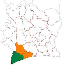 | |
| Tabou Department | ||
* also a commune | ||