Goulia
Goulia is a town in north-western Ivory Coast. It is a sub-prefecture and commune of Kaniasso Department in Folon Region, Denguélé District.
Goulia | |
|---|---|
Town, sub-prefecture, and commune | |
 Goulia Location in Ivory Coast | |
| Coordinates: 10°1′N 7°12′W | |
| Country | |
| District | Denguélé |
| Region | Folon |
| Department | Kaniasso |
| Population (2014)[1] | |
| • Total | 18,590 |
| Time zone | UTC+0 (GMT) |
In 2014, the population of the sub-prefecture of Goulia was 18,590.[2]
Villages
The 18 villages of the sub-prefecture of Goulia and their population in 2014 are:[2]
- Goulia (3 125)
- Kamélézo (412)
- Kohoma (1 134)
- M'béblala (679)
- Niarala (970)
- Samakona (538)
- Bogodougou (334)
- Koba (1 086)
- Kouroulingué (1 289)
- Linguékoro (250)
- Manadoun (1 387)
- Missila (128)
- N'golondié (689)
- Sangouani (549)
- Sokouraba (1 199)
- Tahara (3 642)
- Tienni (649)
- Touroudio (530)
gollark: Attain the 4B 2GB or whatever (there is no 1GB model).
gollark: There's the A, but this is a cutdown one, so yes.
gollark: Yes it is. This is how it works. You simply enter "the military" and emerge after several years with no recollection of what occurs in the intervening time.
gollark: And actual gigabit ethernet.
gollark: Also USB 3.
References
- "Côte d'Ivoire". geohive.com. Retrieved 8 December 2015.
- "RGPH 2014, Répertoire des localités, Région Folon" (PDF). ins.ci. Retrieved 5 August 2019.
Regional seat: Minignan | ||
| Kaniasso Department | 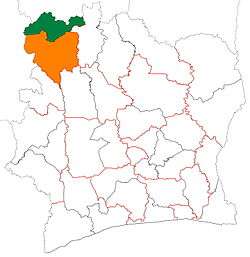 | |
| Minignan Department | ||
* also a commune | ||
This article is issued from Wikipedia. The text is licensed under Creative Commons - Attribution - Sharealike. Additional terms may apply for the media files.