Goring Gap
The Goring Gap is the narrow valley, occupied by the River Thames, between the Chiltern Hills and the Berkshire Downs. It is approximately 10 miles (16 km) upstream of Reading and 27 miles (43 km) downstream of Oxford. The river here forms the county boundary between Berkshire and Oxfordshire.
Half a million years ago the chalk hills at Goring formed a continuous escarpment, which directed the Thames to flow northeastwards to reach the North Sea near Ipswich. During the last ice age, an ice sheet blocked the river's downstream course through Hertfordshire, forcing the water to back up and to form a large lake. The level of the lake eventually became so high, that it overtopped the escarpment and cut a new route through the chalk, creating the Goring Gap. After the ice receded, the Thames continued to follow its new course through Berkshire, as it still does today.[1]
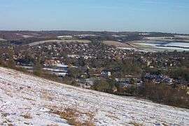
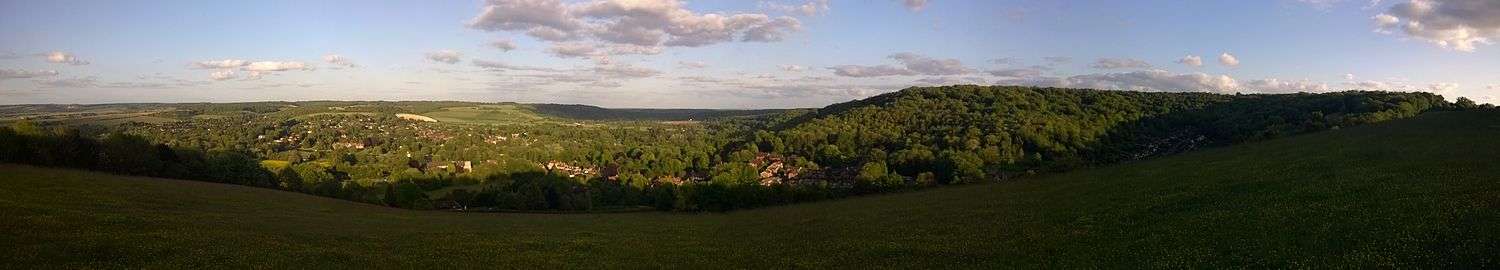
Today, the Goring Gap constricts the River Thames, narrowing the otherwise broad river valley. Steep hills rise southwards to Lardon Chase, the nearest section of the Berkshire Downs while the Chiltern Hills rise to the north. The twin villages of Goring and Streatley straddle the River Thames at the Goring Gap.[2][3] The Thames Path, Icknield Way and the Ridgeway cross the Thames at Goring.
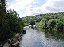
The Goring Gap forms an important communications and transportation corridor. Besides the river itself, which is now limited to navigation for leisure purposes, the gap accommodates the A329 road linking Reading and Oxford, along with the Great Western Main Line railway from London to Bristol and South Wales.[4]
References
- Michael J Crawley. "Geology and Soils" (PDF). Imperial College. Archived from the original (PDF) on 30 June 2007. Retrieved 21 March 2007.
- "GEOGRAPHY & GEOLOGY". Visit Goring and Streatley. Retrieved 23 January 2016.
- "The Goring Gap". Save the Goring Gap. Retrieved 23 January 2016.
- Sir A. STRAHAN, K.B.E., F.R.S (1924). "THE GEOLOGY OF THE THAMES VALLEY NEAR GORING, as illustrated by the Model in the Museum of Practical Geology". Reports & Proceedings—Geologists Association. Mem. Geol. Surv. Retrieved 23 January 2016.CS1 maint: multiple names: authors list (link)
External links
