Goodar Township, Michigan
Goodar Township is a civil township of Ogemaw County in the U.S. state of Michigan. As of the 2000 census, the township population was 493.
Goodar Township, Michigan | |
|---|---|
 Goodar Township, Michigan Location within the state of Michigan | |
| Coordinates: 44°27′20″N 83°55′6″W | |
| Country | United States |
| State | Michigan |
| County | Ogemaw |
| Area | |
| • Total | 36.0 sq mi (93.1 km2) |
| • Land | 35.3 sq mi (91.5 km2) |
| • Water | 0.6 sq mi (1.6 km2) |
| Elevation | 942 ft (287 m) |
| Population (2000) | |
| • Total | 493 |
| • Density | 14.0/sq mi (5.4/km2) |
| Time zone | UTC-5 (Eastern (EST)) |
| • Summer (DST) | UTC-4 (EDT) |
| ZIP codes | 48635 (Lupton, 48761 (South Branch) |
| FIPS code | 26-32860[1] |
| GNIS feature ID | 1626362[2] |
Communities
- South Branch is an unincorporated community in the township along the eastern boundary with Plainfield Township in Iosco County at 44°28′00″N 83°53′20″W[3] It was founded in 1887 and given a post office named "Hunt" in January 1889. In September 1893 the post office was renamed South Branch due to its location on the South Branch of Smith Creek. It was a station on the Detroit and Mackinaw Railway.[4] The South Branch ZIP code 48761 serves the northeast portions of Goodar Township as well as the southern part of Mentor Township in Oscoda County, the western portions of Mitchell Township and Curtis Township in Alcona County and the northwest part of Plainfield Township in Iosco County.[5]
- Lupton is an unincorporated community to the west in adjacent Rose Township and the Lupton ZIP code 48635 serves southern and west parts of Goodar Township.
Geography
According to the United States Census Bureau, the township has a total area of 36.0 square miles (93 km2), of which 35.3 square miles (91 km2) is land and 0.6 square miles (1.6 km2) (1.78%) is water.
Demographics
As of the census[1] of 2000, there were 493 people, 228 households, and 157 families residing in the township. The population density was 14.0 per square mile (5.4/km2). There were 543 housing units at an average density of 15.4 per square mile (5.9/km2). The racial makeup of the township was 97.97% White, 0.41% Native American, 0.20% Asian, 0.41% Pacific Islander, 0.61% from other races, and 0.41% from two or more races. Hispanic or Latino of any race were 1.42% of the population.
There were 228 households, out of which 16.7% had children under the age of 18 living with them, 61.4% were married couples living together, 5.7% had a female householder with no husband present, and 31.1% were non-families. 26.8% of all households were made up of individuals, and 15.8% had someone living alone who was 65 years of age or older. The average household size was 2.16 and the average family size was 2.59.
In the township the population was spread out, with 17.8% under the age of 18, 3.0% from 18 to 24, 17.8% from 25 to 44, 33.9% from 45 to 64, and 27.4% who were 65 years of age or older. The median age was 53 years. For every 100 females, there were 89.6 males. For every 100 females age 18 and over, there were 96.6 males.
The median income for a household in the township was $28,214, and the median income for a family was $30,139. Males had a median income of $26,250 versus $15,714 for females. The per capita income for the township was $14,052. About 11.0% of families and 14.6% of the population were below the poverty line, including 14.3% of those under age 18 and 6.7% of those age 65 or over.
References
- "U.S. Census website". United States Census Bureau. Retrieved 2008-01-31.
- U.S. Geological Survey Geographic Names Information System: Goodar Township, Michigan
- U.S. Geological Survey Geographic Names Information System: South Branch, Michigan
- Romig, Walter (1986) [1973]. Michigan Place Names. Detroit, Michigan: Wayne State University Press. ISBN 0-8143-1838-X.
- 48761 5-Digit ZCTA, 487 3-Digit ZCTA - Reference Map - American FactFinder, U.S. Census Bureau, 2000 census
Municipalities and communities of Ogemaw County, Michigan, United States | ||
|---|---|---|
| Cities | 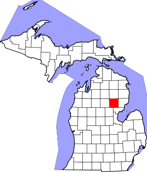 Map of Michigan highlighting Ogemaw County.svg | |
| Village | ||
| Townships | ||
| CDPs | ||