Goldfield, Colorado
Goldfield is a census-designated place (CDP) in Teller County, Colorado, United States. The population as of the 2010 Census was 49.[1]
Goldfield | |
|---|---|
.jpg) Goldfied City Hall and Fire Department | |
 Flag | |
 Location of Goldfield in Teller County, Colorado. | |
 Goldfield Location of Goldfield in Colorado. | |
| Coordinates: 38°43′04″N 105°07′34″W | |
| Country | United States |
| State | Colorado |
| County | Teller |
| Population (2010) | |
| • Total | 49 |
| FIPS code | 08-30890 |
A post office called Goldfield was established in 1895, and remained in operation until 1932.[2] The community was named for a gold mine near the original town site.[3]
Demographics
| Historical population | |||
|---|---|---|---|
| Census | Pop. | %± | |
| U.S. Decennial Census[4] | |||
gollark: They'll *use* one, but not *write their own*.
gollark: You utter heptagon.
gollark: *bleh*
gollark: To write a webapp which will communicate over HTTP with CC.
gollark: They are presumably going to use an HTTP server library.
See also
- Outline of Colorado
- State of Colorado
- Colorado cities and towns
- Colorado census designated places
- Colorado counties
- Colorado metropolitan areas
- Front Range Urban Corridor
- South Central Colorado Urban Area
- Colorado Springs, CO Metropolitan Statistical Area
- Colorado cities and towns
References
- "Colorado Trend Report 2: State and Complete Places (Sub-state 2010 Census Data)". mcdc.missouri.edu. Missouri Census Data Center. Archived from the original on 11 July 2012. Retrieved 25 Feb 2011.
- "Post offices". Jim Forte Postal History. Retrieved 25 June 2016.
- Dawson, John Frank. Place names in Colorado: why 700 communities were so named, 150 of Spanish or Indian origin. Denver, CO: The J. Frank Dawson Publishing Co. p. 24.
- "Census of Population and Housing". Census.gov. Retrieved June 4, 2016.
External links
| Wikimedia Commons has media related to Goldfield, Colorado. |
Municipalities and communities of Teller County, Colorado, United States | ||
|---|---|---|
| Cities | 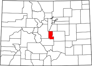 Map of Colorado highlighting Teller County | |
| Town | ||
| CDPs | ||
| Unincorporated community | ||
| Ghost towns | ||
| Footnotes | ‡This populated place also has portions in an adjacent county or counties | |
| Authority control |
|
|---|
This article is issued from Wikipedia. The text is licensed under Creative Commons - Attribution - Sharealike. Additional terms may apply for the media files.