God's Bridge
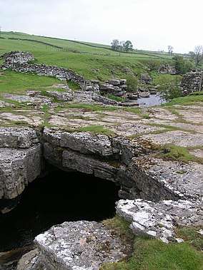
God's Bridge is a Site of Special Scientific Interest in the Teesdale district of south-west County Durham, England. It is a natural limestone bridge over the River Greta, just over 3 km upstream from the village of Bowes.
| God's Bridge | |
|---|---|
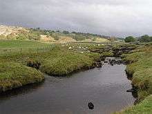
 The Pennine Way crossing the River Greta at God's Bridge | |
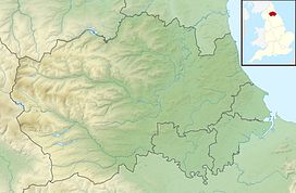 Location of God's Bridge SSSI, Co Durham | |
| Location | Teesdale, North East, England |
| Coordinates | 54°30′33″N 2°4′2″W |
| Area | 9.3 ha (23 acres) |
| Established | 1986 |
| Governing body | Natural England |
| Website | Map of site |
The bridge was formed by a process of cave development in the limestone beneath the river bed and is the best example in Britain of a natural bridge formed in this way. The SSSI covers a portion of the river above and below the bridge where shallow cave development by solutional activity is still taking place.[1]
The Pennine Way crosses the River Greta at God's Bridge.
Yorkshire Dales
A similar formation on the River Doe near Chapel-le-Dale in the Yorkshire Dales has the same name.[2]
gollark: Who are you asking?
gollark: Fortunately it goes over websockets since who likes modems anyway, so I can port it fine.
gollark: Unfortunately all my networking infrastructure works with CConly.
gollark: "Need"? Probably not.
gollark: It could, except something seems to make the comparator detect power buffer and not heat.
References
- "God's Bridge" (PDF). English Nature. 1986. Archived from the original (PDF) on 22 June 2011. Retrieved 20 July 2010.
- OL2 Yorkshire Dales Southern and western areas (Map). 1:25000. Explorer. Ordnance Survey. Retrieved 3 May 2013.
This article is issued from Wikipedia. The text is licensed under Creative Commons - Attribution - Sharealike. Additional terms may apply for the media files.