Gmina Stawiguda
Gmina Stawiguda is a rural gmina (administrative district) in Olsztyn County, Warmian-Masurian Voivodeship, in northern Poland. Its seat is the village of Stawiguda, which lies approximately 16 kilometres (10 mi) south-west of the regional capital Olsztyn.
Gmina Stawiguda Stawiguda Commune | |
|---|---|
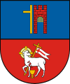
 Coat of arms | |
| Coordinates (Stawiguda): 53°39′31″N 20°23′59″E | |
| Country | |
| Voivodeship | Warmian-Masurian |
| County | Olsztyn County |
| Seat | Stawiguda |
| Area | |
| • Total | 222.52 km2 (85.92 sq mi) |
| Population (2006) | |
| • Total | 5,134 |
| • Density | 23/km2 (60/sq mi) |
| Website | http://www.stawiguda.com.pl |
The gmina covers an area of 222.52 square kilometres (85.9 sq mi), and as of 2006 its total population is 5,134.
Villages
Gmina Stawiguda contains the villages and settlements of Bartąg, Bartążek, Binduga, Ćwikielnia, Dorotowo, Gągławki, Grada, Gryźliny, Jaroty, Kręsk, Majdy, Miodówko, Owczarnia, Pluski, Ruś, Rybaki, Stary Dwór, Stawiguda, Tomaszkowo, Wymój, Zazdrość, Zezuj, Zielonowo and Zofijówka.
Neighbouring gminas
Gmina Stawiguda is bordered by the city of Olsztyn and by the gminas of Gietrzwałd, Olsztynek and Purda.
