Gmina Horyniec-Zdrój
Gmina Horyniec-Zdrój is a rural gmina (administrative district) in Lubaczów County, Subcarpathian Voivodeship, in south-eastern Poland, on the border with Ukraine. Its seat is the village of Horyniec-Zdrój, which lies approximately 18 kilometres (11 mi) east of Lubaczów and 99 km (62 mi) east of the regional capital Rzeszów.
Gmina Horyniec-Zdrój Horyniec-Zdrój Commune | |
|---|---|
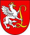
 Coat of arms | |
| Coordinates (Horyniec-Zdrój): 50°11′26″N 23°21′43″E | |
| Country | |
| Voivodeship | Subcarpathian |
| County | Lubaczów |
| Seat | Horyniec-Zdrój |
| Area | |
| • Total | 202.78 km2 (78.29 sq mi) |
| Population (2013[1]) | |
| • Total | 4,931 |
| • Density | 24/km2 (63/sq mi) |
| Website | http://www.horyniec-zdroj.pl/ |
The gmina covers an area of 202.78 square kilometres (78.3 sq mi), and as of 2006 its total population is 4,887.
Villages
Gmina Horyniec-Zdrój contains the villages and settlements of Dziewięcierz, Horyniec-Zdrój, Krzywe, Mrzygłody Lubyckie, Nowe Brusno, Nowiny Horynieckie, Podemszczyzna, Polanka Horyniecka, Prusie, Radruż, Werchrata and Wólka Horyniecka.
Neighbouring gminas
Gmina Horyniec-Zdrój is bordered by the gminas of Cieszanów, Lubaczów, Lubycza Królewska and Narol. It also borders Ukraine.
