Gmina Bolesławiec, Łódź Voivodeship
Gmina Bolesławiec is a rural gmina (administrative district) in Wieruszów County, Łódź Voivodeship, in central Poland. Its seat is the village of Bolesławiec, which lies approximately 12 kilometres (7 mi) south of Wieruszów and 110 km (68 mi) south-west of the regional capital Łódź.
Gmina Bolesławiec Bolesławiec Commune | |
|---|---|
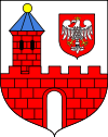
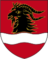
 Flag  Coat of arms | |
| Coordinates (Bolesławiec): 51°11′55″N 18°11′26″E | |
| Country | |
| Voivodeship | Łódź |
| County | Wieruszów |
| Seat | Bolesławiec |
| Area | |
| • Total | 64.58 km2 (24.93 sq mi) |
| Population (2006) | |
| • Total | 4,116 |
| • Density | 64/km2 (170/sq mi) |
| Website | http://www.boleslawiec.net.pl/ |
The gmina covers an area of 64.58 square kilometres (24.9 sq mi), and as of 2006 its total population is 4,116.
Villages
Gmina Bolesławiec contains the villages and settlements of Bolesławiec, Bolesławiec-Chróścin, Chobot, Chotynin, Chróścin, Chróścin-Młyn, Chróścin-Zamek, Gola, Kamionka, Koziołek, Krupka, Mieleszyn, Piaski, Podbolesławiec, Podjaworek, Stanisławówka, Wiewiórka and Żdżary.
Neighbouring gminas
Gmina Bolesławiec is bordered by the gminas of Byczyna, Czastary, Łęka Opatowska, Łubnice and Wieruszów.
