Gmina Żółkiewka
Gmina Żółkiewka is a rural gmina (administrative district) in Krasnystaw County, Lublin Voivodeship, in eastern Poland. Its seat is the village of Żółkiewka, which lies approximately 26 kilometres (16 mi) south-west of Krasnystaw and 43 km (27 mi) south-east of the regional capital Lublin.
Gmina Żółkiewka Żółkiewka Commune | |
|---|---|
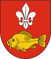
 Coat of arms | |
| Coordinates (Żółkiewka): 50°54′N 22°50′E | |
| Country | |
| Voivodeship | Lublin |
| County | Krasnystaw |
| Seat | Żółkiewka |
| Area | |
| • Total | 130.01 km2 (50.20 sq mi) |
| Population (2006) | |
| • Total | 6,131 |
| • Density | 47/km2 (120/sq mi) |
| Website | http://www.zolkiewka.pl/ |
The gmina covers an area of 130.01 square kilometres (50.2 sq mi), and as of 2006 its total population is 6,131.
Villages
Gmina Żółkiewka contains the villages and settlements of Adamówka, Borówek, Borówek-Kolonia, Celin, Chłaniów, Chłaniów-Kolonia, Chłaniówek, Chruściechów, Dąbie, Gany, Huta, Koszarsko, Majdan Wierzchowiński, Makowiska, Markiewiczów, Olchowiec, Olchowiec-Kolonia, Poperczyn, Rożki, Rożki-Kolonia, Siniec, Średnia Wieś, Tokarówka, Wierzchowina, Władysławin, Wola Żółkiewska, Wólka, Zaburze, Żółkiew-Kolonia and Żółkiewka.
Neighbouring gminas
Gmina Żółkiewka is bordered by the gminas of Gorzków, Krzczonów, Rudnik, Rybczewice, Turobin and Wysokie.
