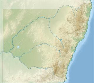
Girilambone, New South Wales
Girilambone is a small village in western New South Wales, Australia. It is located north of Nyngan and 666 km north-west of Sydney built on what was formerly Wangaibon land. It took its name from an Aboriginal word meaning 'place of many stars'.[2] The railway station, opened in 1884 and closed in 1986. The spelling of the station's name was altered to its current form from 'Giralambone' in 1889.[3] The disused station buildings survive in poor condition.[4] Nearby copper mines pre-date the railway station and therefore copper mining is the prime reason for the existence of the settlement.[5]
| Girilambone New South Wales | |
|---|---|
 Girilambone | |
| Coordinates | 31°15′S 146°54′E |
| Population | 107 (2016 census)[1] |
| Location | 70 km (43 mi) N of Nyngan |
| LGA(s) | Bogan Shire |
| Region | Orana (New South Wales) |
| State electorate(s) | Barwon |
| Federal Division(s) | Parkes |
References
- Australian Bureau of Statistics (27 June 2017). "Girilambone (State Suburb)". 2016 Census QuickStats. Retrieved 20 March 2018.

- Girilambone. Sydney Morning Herald, 8 February 2004.
- http://www.nswrail.net/locations/show.php?name=NSW:Girilambone
- Girilambone station. NSWrail.net, accessed 8 September 2009.
- The Sydney Mail and New South Wales Advertiser,10 Feb 1883, p 260
| Preceding station | NSW Main lines | Following station | ||
|---|---|---|---|---|
towards Bourke | Main Western Line (closed section) | Nyngan towards Sydney |
This article is issued from Wikipedia. The text is licensed under Creative Commons - Attribution - Sharealike. Additional terms may apply for the media files.