Gipps County
Gipps County is one of the 141 Cadastral divisions of New South Wales.
| Gipps New South Wales | |||||||||||||||
|---|---|---|---|---|---|---|---|---|---|---|---|---|---|---|---|
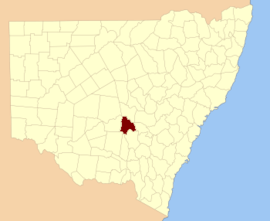 Location in New South Wales | |||||||||||||||
| |||||||||||||||
Gipps County was named in honour of the Governor of New South Wales, Sir George Gipps (1791–1847.[1]
Parishes within this county
A full list of parishes found within this county; their current LGA and mapping coordinates to the approximate centre of each location is as follows:
| Parish | LGA | Coordinates |
|---|---|---|
| Banar | Lachlan Shire Council | 33°15′54″S 147°04′04″E |
| Bena | Lachlan Shire Council | 33°21′54″S 147°16′04″E |
| Bibbijolee | Bland Shire Council | 33°40′54″S 146°53′04″E |
| Bimbeen | Bland Shire Council | 33°39′54″S 147°06′04″E |
| Blow Clear | Bland Shire Council | 33°41′54″S 147°13′04″E |
| Bogandillon | Lachlan Shire Council | 33°17′54″S 147°18′04″E |
| Bolagamy | Bland Shire Council | 33°42′54″S 147°01′04″E |
| Brolga | Bland Shire Council | 33°51′54″S 146°50′04″E |
| Bygalorie | Lachlan Shire Council | 33°27′54″S 146°47′04″E |
| Cadalgulee | Forbes Shire Council | 33°36′54″S 147°33′04″E |
| Cadow | Lachlan Shire Council | 33°18′54″S 147°28′04″E |
| Caragabal | Weddin Shire Council | 33°47′41″S 147°38′59″E |
| Carawandool | Forbes Shire Council | 33°33′54″S 147°41′04″E |
| Clear Ridge | Bland Shire Council | 33°43′54″S 147°17′04″E |
| Cookaburragong | Lachlan Shire Council | 33°20′54″S 147°04′04″E |
| Corringle | Bland Shire Council | 33°38′54″S 147°22′04″E |
| Cowal | Bland Shire Council | 33°42′54″S 147°24′04″E |
| Crown Camp | Lachlan Shire Council | 33°24′54″S 147°01′04″E |
| Currah | Lachlan Shire Council | 33°25′54″S 147°02′04″E |
| Currah | Lachlan Shire Council | 33°29′54″S 147°00′04″E |
| Euglo | Lachlan Shire Council | 33°25′54″S 147°10′04″E |
| Euglo South | Lachlan Shire Council | 33°27′54″S 147°10′04″E |
| Gibrigal | Forbes Shire Council | 33°31′54″S 147°33′04″E |
| Goobothery | Lachlan Shire Council | 33°08′54″S 146°49′04″E |
| Gormans Hill | Lachlan Shire Council | 33°24′54″S 146°48′04″E |
| Hiawatha | Bland Shire Council | 33°48′54″S 147°13′04″E |
| Ilgindrie | Lachlan Shire Council | 33°15′54″S 147°11′04″E |
| Ina | Lachlan Shire Council | 33°23′54″S 147°27′04″E |
| Jemalong West | Forbes Shire Council | 33°30′54″S 147°43′04″E |
| Kalingan | Bland Shire Council | 33°35′54″S 147°09′04″E |
| Lake | Forbes Shire Council | 33°36′54″S 147°30′04″E |
| Livingstone | Lachlan Shire Council | 33°31′54″S 147°12′04″E |
| Manna | Lachlan Shire Council | 33°23′54″S 147°22′04″E |
| Marsden | Weddin Shire Council | 33°44′54″S 147°32′04″E |
| Merribooka | Lachlan Shire Council | 33°20′54″S 146°55′04″E |
| Merrimarotherie | Lachlan Shire Council | 33°15′54″S 147°01′04″E |
| Milbee | Lachlan Shire Council | 33°17′54″S 147°01′04″E |
| Mildil | Bland Shire Council | 33°51′54″S 147°00′04″E |
| Moonbia | Lachlan Shire Council | 33°17′54″S 147°23′04″E |
| Moora Moora | Lachlan Shire Council | 33°27′54″S 147°27′04″E |
| Mulga | Bland Shire Council | 33°53′54″S 147°04′04″E |
| Murrengreen | Bland Shire Council | 33°43′54″S 146°51′04″E |
| Nerang Cowal | Lachlan Shire Council | 33°27′54″S 147°20′04″E |
| Pullabooka | Weddin Shire Council | 33°47′54″S 147°45′04″E |
| Pulligal | Lachlan Shire Council | 33°20′54″S 146°49′04″E |
| South Borambil | Lachlan Shire Council | 33°14′54″S 147°17′04″E |
| South Condobolin | Lachlan Shire Council | 33°08′54″S 147°07′04″E |
| South Gulgo | Lachlan Shire Council | 33°07′54″S 147°02′04″E |
| South Micabil | Lachlan Shire Council | 33°06′54″S 146°54′04″E |
| Thulloo | Bland Shire Council | 33°42′54″S 146°46′04″E |
| Tirranna | Weddin Shire Council | 33°45′54″S 147°40′04″E |
| Towyal | Forbes Shire Council | 33°24′54″S 147°39′04″E |
| Trigalana | Weddin Shire Council | 33°38′54″S 147°37′04″E |
| Udah | Bland Shire Council | 33°47′54″S 147°05′04″E |
| Ugalong | Lachlan Shire Council | 33°31′54″S 147°04′04″E |
| Ungarie | Bland Shire Council | 33°38′54″S 147°02′04″E |
| Wallaroi | Lachlan Shire Council | 33°11′54″S 146°54′04″E |
| Wamboyne | Bland Shire Council | 33°36′54″S 147°13′04″E |
| Warangla | Forbes Shire Council | 33°38′54″S 147°44′04″E |
| Wardry | Lachlan Shire Council | 33°13′54″S 146°50′04″E |
| Warroo | Forbes Shire Council | 33°22′54″S 147°33′04″E |
| Weelah | Lachlan Shire Council | 33°23′54″S 147°15′04″E |
| West Plains | Forbes Shire Council | 33°31′54″S 147°39′04″E |
| Wheoga | Forbes Shire Council | 33°41′54″S 148°00′04″E |
| Wilbertroy | Forbes Shire Council | 33°27′54″S 147°33′04″E |
| Wilga | Lachlan Shire Council | 33°22′45″S 146°54′40″E |
| Wilga South | Lachlan Shire Council | 33°27′54″S 146°54′04″E |
| Wollongough | Bland Shire Council | 33°33′31″S 146°54′09″E |
| Wyalong | Bland Shire Council | 33°54′54″S 147°10′04″E |
| Yarnel | Lachlan Shire Council | 33°20′54″S 147°10′04″E |
| Younga Plain | Bland Shire Council | 33°43′54″S 147°06′04″E |
| Youngareen | Bland Shire Council | 33°38′54″S 146°46′04″E |
gollark: Nope.
gollark: Also, I already have remote editing capability.
gollark: Do you mean the privacy policy?
gollark: The license is MIT.
gollark: I could make it actually pull from the wiki but it'd have to strip markup.
References
- "Gipps". Geographical Names Register (GNR) of NSW. Geographical Names Board of New South Wales. Retrieved 3 August 2013.

This article is issued from Wikipedia. The text is licensed under Creative Commons - Attribution - Sharealike. Additional terms may apply for the media files.