Giard Point
Giard Point (64°26′S 63°49′W) is a point forming the north extremity of Obitel Peninsula and the south side of the entrance to Perrier Bay, on the northwest coast of Anvers Island in the Palmer Archipelago, Antarctica. It was first charted by the French Antarctic Expedition, 1903–05, and named by Jean-Baptiste Charcot for Alfred Giard, a noted French zoologist and member of the Institut de France.[1]
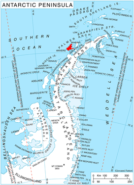
Location of Anvers Island in the Antarctic Peninsula region.
Maps
- British Antarctic Territory. Scale 1:200000 topographic map. DOS 610 Series, Sheet W 64 62. Directorate of Overseas Surveys, UK, 1980.
- Antarctic Digital Database (ADD). Scale 1:250000 topographic map of Antarctica. Scientific Committee on Antarctic Research (SCAR), 1993–2016.
gollark: Expect:100G silverrandom hatchlingsCB gold taken down while you're staring at it in confusion
gollark: Nobody actually *reads* that.
gollark: ~~gets banned for putting text in want box~~
gollark: ~~banned for no caps~~
gollark: no eggs no eggs no eggs no eggs no eggs only please read this help me
References
- "Giard Point". Geographic Names Information System. United States Geological Survey. Retrieved 2012-04-23.
![]()
This article is issued from Wikipedia. The text is licensed under Creative Commons - Attribution - Sharealike. Additional terms may apply for the media files.