Gboguhé
Gboguhé is a town in western Ivory Coast. It is a sub-prefecture and commune of Daloa Department in Haut-Sassandra Region, Sassandra-Marahoué District.
Gboguhé | |
|---|---|
Town, sub-prefecture, and commune | |
 Gboguhé Location in Ivory Coast | |
| Coordinates: 6°45′N 6°35′W | |
| Country | |
| District | Sassandra-Marahoué |
| Region | Haut-Sassandra |
| Department | Daloa |
| Population (2014)[1] | |
| • Total | 58,103 |
| Time zone | UTC+0 (GMT) |
In 2014, the population of the sub-prefecture of Gboguhé was 58,103[2].
Villages
The 36 villages of the sub-prefecture of Gboguhé and their population in 2014 are[2]:
- Baléa (1 425)
- Brakaguhé (863)
- Brohouan (1 053)
- Gbieguhé (808)
- Gboguhé (3 289)
- Gokra (2 164)
- Guédékipréa (680)
- Guédiboua (1 331)
- Kékégoza (1 452)
- Koréa 2 (1 496)
- Krikoréa 1 (1 223)
- Krikoréa 2 (914)
- Liguéguhé (1 080)
- Ziguédia (1 223)
- Zoboua (1 407)
- Batéguédia 1 (1 062)
- Batéguédia 2 (892)
- B-Koukoguhé (4 032)
- Bribouo (722)
- Digbapia (2 775)
- Doboua (1 557)
- Gosséa (1 043)
- Kéibla (2 558)
- Kibouo (1 454)
- Koréa 1 (828)
- Kramoua (271)
- Loboguiguia (1 907)
- Noumousséria 1 (1 617)
- Noumousséria 2 (1 819)
- Noumousséria 3 (1 110)
- Sébraguhé (773)
- Yokoréa (2 839)
- Zahia (4 143)
- Zébra (3 780)
- Zétodigba (682)
- Zobéa (1 831)
Notes
- "Côte d'Ivoire". geohive.com. Retrieved 7 December 2015.
- "RGPH 2014, Répertoire des localités, Région Haut-Sassandra" (PDF). ins.ci. Retrieved 5 August 2019.
Regional seat: Daloa | ||
| Daloa Department | 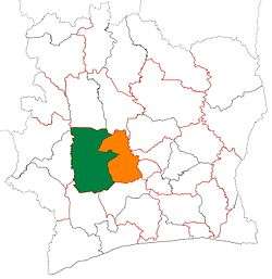 | |
| Issia Department | ||
| Vavoua Department | ||
| Zoukougbeu Department | ||
* also a commune | ||
gollark: Apparently they just copypasted a sorting algorithm off the internet.
gollark: It is ALWAYS profiling time.
gollark: Added to your much-left-having profile.
gollark: · · ·
gollark: Well, the ratio of what you can do about them to how much they affect you is better.
This article is issued from Wikipedia. The text is licensed under Creative Commons - Attribution - Sharealike. Additional terms may apply for the media files.