Gardiner Airport
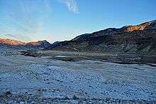
Gardiner Airport (FAA LID: 29S) is a public use airport located two nautical miles (3.7 km) northwest of the central business district of Gardiner, a city in Park County, Montana, United States. The airport is owned by the city and county.[1]
Gardiner Airport | |||||||||||
|---|---|---|---|---|---|---|---|---|---|---|---|
 | |||||||||||
| Summary | |||||||||||
| Airport type | Public | ||||||||||
| Owner | City of Gardiner & Park County | ||||||||||
| Serves | Gardiner, Montana | ||||||||||
| Elevation AMSL | 5,286 ft / 1,611 m | ||||||||||
| Coordinates | 45°03′00″N 110°44′48″W | ||||||||||
| Runways | |||||||||||
| |||||||||||
| Statistics (2004) | |||||||||||
| |||||||||||
Facilities and aircraft
Gardiner Airport covers an area of 38 acres (15 ha) at an elevation of 5,286 feet (1,611 m) above mean sea level. It has one asphalt paved runway designated 10/28 which measures 3,200 by 55 feet (975 x 17 m).[1]
For the 12-month period ending August 31, 2004, the airport had 8,600 aircraft operations, an average of 23 per day: 93% general aviation and 7% air taxi. At that time there were 9 aircraft based at this airport, all single-engine.[1]
gollark: The Switchcraft chat viewer appears to have XSS issues.
gollark: The Kristpocalypse?
gollark: Oh, works now.
gollark: I have, several times.
gollark: SC appears to be down.
References
- FAA Airport Master Record for 29S (Form 5010 PDF), effective 2009-07-02.
External links
- Resources for this airport:
- FAA airport information for 29S
- AirNav airport information for 29S
- FlightAware airport information and live flight tracker
- SkyVector aeronautical chart for 29S
This article is issued from Wikipedia. The text is licensed under Creative Commons - Attribution - Sharealike. Additional terms may apply for the media files.