Freweyni
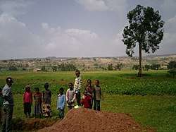
Freweyni (also known as Sinkata) is a town in northern Ethiopia. Located 80 kilometers north of Mekele in the Misraqawi Zone of the Tigray Region (or kilil) of Ethiopia, this town has a latitude and longitude of 14°3′N 39°34′E with an elevation of 2480 meters above sea level and is located along Ethiopian Highway 2.
Freweyni Sinkata | |
|---|---|
 | |
 Flag | |
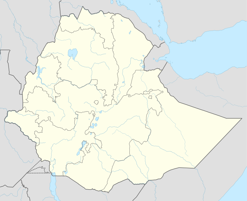 Freweyni Location within Ethiopia | |
| Coordinates: 14°3′N 39°34′E | |
| Country | Ethiopia |
| Region | Tigray |
| Zone | Misraqawi Zone |
| Woreda | Saesi Tsaedaemba |
| Elevation | 2,480 m (8,140 ft) |
| Time zone | UTC+3 (EAT) |
Naming
During the Italo-Abyssinian War, a large group of Ethiopian soldiers, marching to the north to fight the Italians, arrived almost starving at the town of Freweyni. In honour of this march, the town was renamed to Sinkata. In 1991, after the EPRDF seized power, new administrative divisions came into place. South of the town, a suburban tabia was created. To distinguish the town tabia from the surrounding tabia, the name of the town was changed again to Freweyni. The surrounding of Sinkata kept the Sinkata name. Nowadays, both Freweyni and as well as Sinkata are still commonly used to refer to the town.
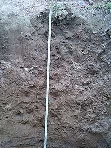
Geology and soils
The following geological formations are present in this locality:[1]
The main geomorphic units, with corresponding soil types are:[2]
- East of Freweyni: Suluh plains with metavolcanic rocks
- Associated soil types
- Inclusions
- Sinkata plain, west of the town
- Associated soil types
- shallow sandy soils with an indurated layer which prevents rooting and drainage (Petric Plinthosol)
- moderately deep, (light) brown, loamy to loamy sandy soil (Chromic Cambisol, Arenic Luvisol, Arenic Lixisol)
- Inclusions
- complex of rock outcrops, very stony and very shallow soils ((Lithic) Leptosol)
- shallow, stony loam soils (Eutric Regosol and Cambisol)
- deep, very hard cracking clays with good natural fertility, waterlogged during the wet season (Mazic (Sodic) Vertisol)
- brown to dark, silty clay loams to loamy sands developed on alluvium, with good natural fertility (Fluvisol)
- Associated soil types
Notes
- Sembroni, A.; Molin, P.; Dramis, F. (2019). Regional geology of the Dogu'a Tembien massif. In: Geo-trekking in Ethiopia's Tropical Mountains — The Dogu'a Tembien District. SpringerNature. ISBN 978-3-030-04954-6.
- Nyssen, Jan; Tielens, Sander; Gebreyohannes, Tesfamichael; Araya, Tigist; Teka, Kassa; Van De Wauw, Johan; Degeyndt, Karen; Descheemaeker, Katrien; Amare, Kassa; Haile, Mitiku; Zenebe, Amanuel; Munro, Neil; Walraevens, Kristine; Gebrehiwot, Kindeya; Poesen, Jean; Frankl, Amaury; Tsegay, Alemtsehay; Deckers, Jozef (2019). "Understanding spatial patterns of soils for sustainable agriculture in northern Ethiopia's tropical mountains". PLoS ONE. 14 (10): e0224041. doi:10.1371/journal.pone.0224041. PMC 6804989. PMID 31639144.