Florida State Road 700
State Road 700 (SR 700) is the mostly unsigned Florida Department of Transportation state road designation of U.S. Route 98 (US 98) between Chassahowitzka (where US 98 continues northward as unsigned SR 55) and Twentymile Bend (where US 98 continues eastward as signed SR 80). The only segments of State Road 700 that are signed are between SR 50A and US 41 in Brooksville, and from Okeechobee south, through Canal Point, to SR 80. From the northernmost signed point, it's an unsigned concurrency with SR 45(US 41), then with SR 50, before rejoining US 98 at the west end of the US 98/SR 50 concurrency. The section between Canal Point to SR 80 is signed only as State Road 700 since the relocating of US 98 to run concurrent with US 441 in Palm Beach County.
.JPG)
| ||||
|---|---|---|---|---|
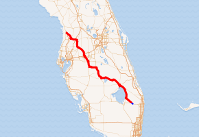
SR 700 in red, CR 700 in blue | ||||
| Route information | ||||
| Maintained by FDOT | ||||
| Length | 225.081 mi[1] (362.233 km) | |||
| Major junctions | ||||
| North end | ||||
| East end | ||||
| Highway system | ||||
| ||||

Cities served by US 98/SR 700 include:
A 4.847-mile (7.800 km) extension of SR 700 in Palm Beach County to County Road 880 (CR 880) is known as County Road 700.[2]
Major intersections
| County | Location | mi[1] | km | Destinations | Notes | ||
|---|---|---|---|---|---|---|---|
| Citrus | | 0.000 | 0.000 | North end of US 98 overlap | |||
| see US 98 (mile 409.439-442.917), US 301 (mile 92.506-86.810) | |||||||
| Pasco | Dade City | 39.174 | 63.044 | South end of US 98 / US 301 overlap | |||
| 39.351 | 63.329 | North end of state maintenance | |||||
| 39.8[3] | 64.1 | ||||||
| 40.411 | 65.035 | South end of state maintenance | |||||
| 40.485 | 65.154 | North end of US 98 / US 301 overlap; no left turn southbound | |||||
| see US 301 (mile 85.208-83.074), US 98 (mile 452.349-477.537) | |||||||
| Polk | Lakeland | 67.807 | 109.125 | South end of US 98 / SR 35 overlap; north end of US 92 / SR 546 overlap | |||
| 67.996 | 109.429 | ||||||
| 68.811 | 110.741 | South end of US 92 / SR 546 overlap | |||||
| 69.545 | 111.922 | East Main Street (SR 600) - Auburndale, Plant City | |||||
| 69.947 | 112.569 | North end of US 98 / SR 35 overlap | |||||
| see US 98 (mile 479.255-585.442), US 441 (mile 138.841-104.525) | |||||||
| Palm Beach | Canal Point | 210.450 | 338.686 | East end of US 98 / US 441 / SR 15 overlap | |||
| | 215.925 | 347.498 | |||||
| | 225.081 | 362.233 | |||||
1.000 mi = 1.609 km; 1.000 km = 0.621 mi
| |||||||
- Spur in Brooksville
The entire route is in Brooksville, Hernando County.
| mi[1] | km | Destinations | Notes | ||
|---|---|---|---|---|---|
| 0.000 | 0.000 | ||||
| 0.330 | 0.531 | ||||
| 1.000 mi = 1.609 km; 1.000 km = 0.621 mi | |||||
References
- FDOT straight line diagrams Archived March 6, 2014, at the Wayback Machine, accessed March 2014
- "County Roads TDA". FDOT. Retrieved February 4, 2020.
- Google Maps distance