Florida State Road 33
State Road 33 (SR 33) is a state highway running through Lake and Polk counties in Florida.
| ||||
|---|---|---|---|---|
| Route information | ||||
| Maintained by FDOT | ||||
| Length | 42.687 mi[1] (68.698 km) | |||
| Major junctions | ||||
| South end | ||||
| North end | ||||
| Highway system | ||||
| ||||

Route description
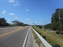
State Road 33 begins in Lakeland off US 92 and heads north to Polk City. From there, it traverses through mostly rural farmland into Lake County and Groveland. In Groveland, it intersects and begins a 3 miles (4.8 km) concurrency with SR 50, up to Mascotte. Now a county road, CR 33 continues through another 10 miles (16 km) or so of rural farmland, passes under Florida's Turnpike, and ends on US 27 in Okahumpka.
Major intersections
| County | Location | mi[1] | km | Destinations | Notes |
|---|---|---|---|---|---|
| Polk | Lakeland | 0.000 | 0.000 | ||
| 2.931 | 4.717 | ||||
| 3.572 | 5.749 | I-4 exit 33 | |||
| 6.046 | 9.730 | ||||
| 7.69 | 12.38 | I-4 exit 38 | |||
| Polk City | 13.503 | 21.731 | |||
| 13.702 | 22.051 | ||||
| Polk–Lake county line | | Bridge over Withlacoochee River | |||
| Lake | | 27.460 | 44.193 | ||
| | 29.803 | 47.963 | |||
| | 36.547 | 58.817 | |||
| Groveland | 40.216 | 64.721 | south end of SR 50 overlap; signage changes northbound from SR 33 to CR 33 | ||
| 40.541 | 65.244 | Southern terminus of SR 19 | |||
| 41.312 | 66.485 | ||||
| Mascotte | 42.687 | 68.698 | north end of SR 50 overlap and state maintenance | ||
| Leesburg | 54.1[2] | 87.1 | south end of CR 48 overlap | ||
| Okahumpka | 54.7[2] | 88.0 | north end of CR 48 overlap | ||
| | 56.049 | 90.202 | |||
1.000 mi = 1.609 km; 1.000 km = 0.621 mi
| |||||
gollark: What was wrong with `u64` or something?
gollark: ```c typedef uint64_t c3_d; // double-word typedef int64_t c3_ds; // signed double-word typedef uint32_t c3_w; // word typedef int32_t c3_ws; // signed word typedef uint16_t c3_s; // short typedef int16_t c3_ss; // signed short typedef uint8_t c3_y; // byte typedef int8_t c3_ys; // signed byte typedef uint8_t c3_b; // bit```Wow, this is HIGHLY readable.
gollark: Urbit contains C code for purposes, I assume.
gollark: I do not, however, have any idea why, since I only changed the multicast address.
gollark: Remember how a while ago I was working on a multicast-based chat thing which mysteriously failed and lead me to complain about POSIX or whatever's socket API? I found a random stackoverflow question which prompted me to change one line and it somewhat works now.
References
| Wikimedia Commons has media related to Florida State and County Roads 33. |
- FDOT straight line diagrams Archived March 6, 2014, at the Wayback Machine, accessed February 2014
- Google Maps distance
This article is issued from Wikipedia. The text is licensed under Creative Commons - Attribution - Sharealike. Additional terms may apply for the media files.