Ferwerderadiel
Ferwerderadiel (![]()
Ferwerderadiel Ferwerderadeel | |
|---|---|
Canal through Burdaard | |
 Flag  Coat of arms | |
.svg.png) Location in Friesland | |
| Coordinates: 53°20′N 5°50′E | |
| Country | Netherlands |
| Province | Friesland |
| Government | |
| • Body | Municipal council |
| • Mayor | Wil van den Berg (CDA) |
| Area | |
| • Total | 133.18 km2 (51.42 sq mi) |
| • Land | 97.71 km2 (37.73 sq mi) |
| • Water | 35.47 km2 (13.70 sq mi) |
| Elevation | 1 m (3 ft) |
| Time zone | UTC+1 (CET) |
| • Summer (DST) | UTC+2 (CEST) |
| Postcode | 9070–9179 |
| Area code | 0518, 0519, 058 |
| Website | www |
Population centres
Bartlehiem, Blije, Burdaard, Ferwert, Ginnum, Hallum, Hegebeintum, Jannum, Jislum, Lichtaard, Marrum, Reitsum, Wânswert, Westernijtsjerk.
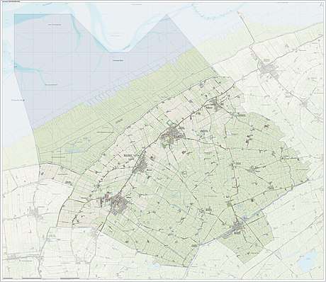
Topography

'Dutch topographic map of the municipality of Ferwerderadiel, June 2015
Notable people

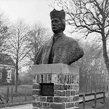
St. Fredk. van Hallum
- Saint Frederick of Hallum (ca. 1113 – 1175) a Premonstratensian priest
- Barthold Douma van Burmania (1695 in Hallum – 1766) a Dutch statesman and ambassador to the court of Vienna
- Pieter Boeles (1795 in Ferwerd – 1875) a Dutch Minister and linguist
- Gerardus Heymans (1857 in Ferwert – 1930) a Dutch philosopher, psychologist and academic
- Watse Cuperus (1891 in Blije – 1966) a Dutch journalist and writer in the West Frisian language
- Eeltsje Boates Folkertsma (1893 in Ferwert – 1968) a West Frisian language writer
- Maria Sterk (born 1979 in Hallum) a Dutch marathon speed skater
Gallery
- Birdaard, drawbridge and church
- Ferwerd, Vrijhof and church
- Marrum, church
- Hallum, church
gollark: No, I also use MultiMC. I just use an older version which does not seem to force me to migrate.
gollark: That's just MultiMC doing things. I have a slightly old version.
gollark: Trivially.
gollark: Well, I can still join stuff despite never getting round to migrating.
gollark: i.e. not the same as "Android 12".
References
- "Kerncijfers wijken en buurten" [Key figures for neighbourhoods]. CBS Statline (in Dutch). CBS. 2 July 2013. Retrieved 12 March 2014.
- "Postcodetool for 9172PJ". Actueel Hoogtebestand Nederland (in Dutch). Het Waterschapshuis. Archived from the original on 21 September 2013. Retrieved 8 September 2013.
External links

- Official website
This article is issued from Wikipedia. The text is licensed under Creative Commons - Attribution - Sharealike. Additional terms may apply for the media files.